
Compared to the billion-old mountains of the Blue Ridge in western Virginia,
the Chesapeake Bay is just a pup. As recently as 10,000 years ago, the Susquehanna
River flowed through the area between Havre de Grace, MD, and Virginia Beach,
VA, that is now covered by the Chesapeake Bay. But by that time, the waters
of the rising Atlantic Ocean were knocking at the door of the bay about to be
born.
The stage began to be set for the creation of this large estuary with the close of the Pleistocene Epoch, starting some 20,000 years ago. The land at that time was inhabited by large, now-extinct mammals such as the wooly mammoth, the mastodon, and peccary. Mammoths (Mammuthus) were hairy-skinned and had long upward-curving tusks. Mastodons (Mastodontidae) were larger even than mammoths and elephants. The peccary (Tayassuidae) was a piglike creature with sharp tusks.
Fossils indicate that Ice Age people roamed the forests, hunting these enormous creatures with spears. By about 10,000 years ago, most of the large mammals were extinct, and even camels and horses were extirpated from the North American continent. Were they overhunted, like the buffalo and wolf were in more recent times? Did a change in climate do them in? Scientists still speculate about the cause.
As the last glaciers retreated between 18,000 and 12,000 years ago, the Susquehanna River transported the melting waters from the north in an ever-deepening chasm, just as it had done at the end of previous glacial periods. Glaciers had extended as far south as what is now northern Pennsylvania. So much water was locked up in the ice cap that the seas were some 325 feet below their current level.
The melting waters caused the seas to rise on the East Coast, gradually backing up into the Susquehanna River Valley at a rate of 50 feet a year, flooding over the banks, finally claiming about a third of the ancient Susquehanna for the new bay. Woods bison, elk, and wolves retreated as the waters spread. Archeologists have also uncovered evidence of human habitation during the time the bay was forming by a seminomadic people of the Paleoindian Period, which lasted from 11,000 to 7,500 BC. These people gradually put down roots, creating permanent villages during the Woodland Period (1000 BC to 1600 AD).
This process of bay creation did not occur overnight. In fact, the sea only reached its northernmost limit at Havre de Grace, MD, about 3,000 years ago. The pattern is a typical one for bays on the Atlantic Seaboard as glaciers come and go over the millennia. The Susquehanna has weathered such treatment before and will continue to do so from all indications, say geologists.
The bay that formed as the rising seawaters drowned the river valley came to be known as Chesepiooc, or "great shellfish bay," by the Algonquin Indians who were living along its shoreline when the first European settlers arrived.
The Chesepiooc, or Chesapeake Bay, covers 2,500 square miles and is North Americas largest estuary.
Lets try to get a feeling for the size. Some figures and comparisons might help.
The bay proper, disregarding the tributary rivers, lies entirely within the states of Maryland and Virginia. It varies from 4 miles wide at Annapolis, MD, where it is spanned by the Bay Bridge, to 30 miles wide at Smith Point, VA. It is 195 miles in length, from the mouth of the Susquehanna River at the head of the bay in Maryland to the southern end at Hampton Roads in Virginia.
If you decided to prowl every cove and inlet, tracing the shoreline around the bay, you would travel an estimated 4,000 miles before you would come full circle. If you add the tributary rivers to the journey, the mileage would double. Just traveling around the bay itself, you would cover more ground than would someone following the western coastline from Canada to Mexico. Even a trip from Maine to California would be only three-quarters the distance of the Chesapeake Bay shoreline. A mere 2 percent of that shoreline is in the public domain.
Rain that falls over a 64,000-square-mile area, supplying water to some 15 million people in portions of six states ends up in the Chesapeake Bay. These states included in the Chesapeake Bay watershed are Virginia, West Virginia, Maryland, Delaware, Pennsylvania, and New York, as well as the District of Columbia. Follow the bay to its headwaters, and youll wind up at Otsego Lake in Cooperstown, New York, where the Susquehanna River begins. Put fertilizer on your yard in Elmira, New York, or Scranton, Pennsylvania, and it will end up eventually in the Chesapeake Bay.
For all its size, the bay is shallow, averaging just 22 feet deep. Some holes and channels are deeper, with the deepest place measured at 174 feet just south of Kent Island, MD. The shallowness is important, because it allows sunlight to reach plant life and helps the estuary stay warm.
Put simply, an estuary is nothing more than a partially enclosed area where the fresh water of rivers mixes with tidal salt water.
The definition may be accurate, but much is left unsaid. Estuaries perform vital functions, and their systems are interrelated. Get one system out of balance and others are affected, like tipping over the first domino in a row. Because of the enormity of the Chesapeake Bay, the importance of keeping its systems in good working order are greatly magnified.
Salinity of an estuary like the Chesapeake is influenced by several factors. Typically, the farther away from the sea you go, the fresher the water becomes. The northern part of the Chesapeake Bay, although tidal, is much less salty than the lower part of the bay.
Seasonal changes also cause salinity variations. During spring rains, the influx of fresh water causes a decline in salinity. In late summer and fall or during a drought, when the influx of fresh water is low, overall salinity may increase dramatically, and blue crabs and some saltwater fish may travel all the way to the fall lines of some tributaries.
Approximately twice a day, shorelines experience two high tides and two low tides. At low tide, mud flats that may have had several feet of water covering them at high tide are exposed to the air and sun.
Over the eons, aquatic life has evolved in harmony with these fluctuations. In fact, the different gradients of salinity from the ocean to the fall lines provide conditions suitable to a much greater variety of life than would be possible without the variations. An estimated 2,700 species of plants and animals, including 200 species of fish, live in the estuary. Some of these organisms live wholly or mostly in one part of the estuary or one level of salinity, while others travel from one area to the other. Various terms are used to describe the groups of organisms that have adapted to various salinity levels.
Euryhaline species, for example, are those with the most tolerance for changes in salinity, such as spot and Atlantic croaker. Anadromous is the term for saltwater species of fish such as striped bass, shad, river herring, and sturgeon that come upriver to spawn in fresh water.
The mouth of the estuary is where the bay meets the Atlantic Ocean between Cape Charles and Cape Henry in Virginia. The head of the estuary is at the mouth of the Susquehanna at Havre de Grace, Maryland, and at the fall line of each tributary river. The fall line marks the end of the Piedmont Plateau, so named because the water often goes over falls on the Piedmont escarpment before it reaches sea level, where the Coastal Plain begins. The Piedmont physiographic region is composed of metamorphic rock that is more erosion resistant than the softer, sedimentary rock of the Coastal Plain.
Some rivers, such as the Mattaponi, on Virginias western bay, have fall lines that are hardly discernible as the waters subtly go from nearly flat land to sea level. Others, however, are memorable.
A series of rapids on the James River fall line in the heart of Richmond, Virginia, is well known to whitewater kayakers and canoeists. A white-knuckle ride down the Great Falls of the Potomac above Washington, DC, runs through a 9-mile fall zone ending at the true fall line near Roosevelt Island at Washington. (Over the years, the falls have continually eroded away the edge of the Piedmont escarpment at Washington, so that the first 20-foot vertical drop now begins 9 miles upstream from its original edge at Roosevelt Islanda phenomenon called headward erosion.) Tackling the series of falls, boils, chutes, and twists down this section of the Potomac should only be undertaken by experts who have carefully scouted the riverand made out their wills. Some parts of the falls should not be attempted by anyone. There have been many deaths from swimmers or boaters swept into the falls by accident.
The escarpment that creates the fall lines of rivers also creates obstacles to shipping, influencing the way early Europeans settled the land. Cities such as Richmond (on the James River), Fredericksburg (on the Rappahannock), Washington (on the Potomac), and Baltimore (on the Patapsco) grew up at the fall lines of rivers where ships would unload goods and supplies.
Also, dams were built at many fall lines to supply power to the cities. It took years to realize the damming of the rivers had consequences that werent all good. Anadromous fishsaltwater fish that make annual spring runs upriver to spawn in fresh waterbegan to disappear. No longer could you walk into the river and scoop up shad, herring, sturgeon, and striped bass in buckets and nets. Lacking a net, Capt. John Smith even wrote of catching fish in a frying pan.
What follows is a discussion of the intricate workings of the Chesapeake Bay itself, from plant and animal communities at the high tide mark to the deepest waters. Of course, the Chesapeake Bay is strongly influenced by land or stream disturbances that occur anywhere within the watershed. This influence extends not only up the tributary streams and rivers and to the forested uplands that surround the bay, but also to the tiniest rivulet in the mountains of the six-state area of the Chesapeake Bay watershed.
Wherever a homeowner sprays his garden for pests or a farmer allows his cattle into a stream within the entire watershed, pesticide from the spray and the excess nutrients from cattle dung will eventually find their way into the vulnerable Chesapeake Bay. So important is wise stewardship that some states have adopted laws requiring certain permits for any work done in streams or rivers, or for the building of bridges and culverts, even hundreds of miles from the bay. Environmentalists complain that the permits are mostly a formality. What is lacking, they say, is a plan with limits to the permits based on the total effect of disturbances to the watershed.
Scoop up a glass of water from the Chesapeake Bay. Doesnt matter wherefrom the deep waters to the shallows to the water that filters through the beach sand and the marshesand put a drop of it under a microscope. What may have looked like a completely clear glass of water turns out to be anything but.
The water is filled with a veritable soup of free-floating plants and animals collectively called plankton. Plankton is further subdivided into the aquatic plant community, called phytoplanktonliterally "green-celled wanderers"and zoo-plankton, or animal plankton. Phytoplankton, like plants the world over, harness sunlight to carry on photosynthesis, and produce tremendous amounts of oxygen. Examples of phytoplankton include single-celled organisms such as algae, dinoflagellates, and diatoms. Large collections of blue-green algae can actually turn the water green in tidal freshwater or slightly brackish marshes. Diatoms, which are one-celled plants often found in clusters, are composed of silicathe same glassy mineral found in quartz and opal. Diatoms form the basis of the food chain.
Zooplankton includes copepods, waterfleas, and larvae of larger creatures such as snails, oysters, crabs, barnacles, and striped bass. The phytoplankton are eaten by the zooplankton, which, in turn, are eaten by larger animals in the food chain.
The importance of phytoplankton to the health of the estuaryindeed, to the worldcannot be overrated. Phytoplankton are the true lungs of the earth, producing 80 percent of the worlds oxygen. Approximately 75 percent of the organic material on earth is produced by phytoplankton. If the phytoplankton should crash, the entire chain of life would crumble as if a child were to pull the lower piece from a stack of building blocks.
Tidal marshes are wetlands in the tidal zone characterized by grass-like vegetation. Marshes form a vital transition area between shallow water and uplands. Depending on their location, water in tidal marshes can be fresh, salty, or brackish, with daily, seasonal, and annual variations. The saltiness of a marsh greatly affects the type of life the marsh supports. Generally speaking, the fresher the marsh, the greater the variety of organisms that live there. Salt water poses problems for plants and animals that require adaptations for survival.
Complex ecosystems have evolved to thrive in the tidal fluctuations of marshes in the Chesapeake Bay watershed. Incoming tides bring nutrients needed by marsh plants for optimal growth. Larvae that depend on the marsh for sustenance are also brought in by waves and currents. Outgoing tides flush the marsh of decaying organic matter called detritus, carrying it to other environments where it serves as food for microorganisms and minute aquatic invertebrates. Species higher on the food chain such as aquatic insects, fish, birds, and mammals feed on the microorganisms, in turn.
In addition, marshes provide shelter and food for a wide variety of birds, mammals, reptiles, amphibians, fish, and shellfish. Many North American bird species use wetlands, according to the Chesapeake Bay Foundation. More than two-thirds of Atlantic and Gulf Coast fish and shellfish that are significant commercially rely on wetlands for at least part of their lives, say biologists at the National Marine Fisheries Service. These include striped bass, menhaden, bluefish, flounder, spot, blue crabs, oysters, and clams.
Before humans gained an understanding of their importance, wetlands were viewed as an obstacle to development and transportation. Farming the soggy ground was a challenge, although some people figured ways to do it. The marshes and swamps also challenged the ingenuity of developers and road builders. Consequently, thousands of acres were lost to ditching and draining or to filling operations. Now, in the light of research and media coverage, marshes are seen for the critical part they play as filters for pollutants, buffers that protect the shoreline and soil from waves and wind, and as nesting grounds, nurseries, food providers, and hiding places for fish, birds, crustaceans, and other life forms.
Tidal wetlands can be divided into freshwater, brackish, and saltwater habitats.
Any angler who has sought out lily pads to find bass or pike, then silently cursed the plants for snagging his hook, has come face to face with some of the vegetation that is key to the health of tidal freshwater marshes. These marshes occur at the head of the Chesapeake Bay and along the upper reaches of the tidal portions of tributary rivers.
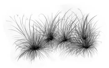
Besides the yellow pond lily or spatterdock (Nuphar luteum), plants associated with tidal freshwater marshes include broad-leaved plants called emergents extending above the water surface such as arrow arum (Pedtandra virginica) and pickerelweed (Pontederia cordata). Growing closer to waters edge are narrow-leaved cattails (Typha augustifolia), marsh hibiscus (Hibiscus moscheutos), American three-square (Scirpus pungens), and various rushes and sedges. Large expanses of wild rice (Zizanis aquatica) grow in the mud of the shallows.
Insects such as dragonflies, damselflies, honeybees, and butterflies flying above a freshwater marsh allude to the rich variety of life sustained here. Of course, there are also the ubiquitous biting flies, midges, and mosquitoes to contend with. A closer inspection reveals grasshoppers, crickets, and a variety of bugsall of which attract insect-eaters such as swallows, flycatchers, and even spiders. The freshwater marsh is also home to reptiles and amphibians not found in the salt marsh such as the green frog (Rana clamitans melanota), the Eastern painted turtle (Chrysemys picta picta), and the Eastern ribbon snake (Thamnophis sauritus sauritus). Great blue herons, great egrets, a variety of marsh ducks, rails, sandpipers, and songbirds find protection and food in the marshes.
Beneath the surface are crustaceans such as the transparent freshwater grass shrimp (Palaemonetes paludosus), and mollusks such as the common river snail (Goniobasis virginica). Buried in the mud are even more critters, including freshwater mussels (Anodonta).
Freshwater habitats are discussed in the sections on Head of the Chesapeake Bay, Elk Neck State Park, Idylwild Wildlife Management Area, and Tuckahoe State Park.
The farther down river from the fall line of tributary rivers and the closer to the mouth of the bay you go, the more brackish the tidal marshes are along the shoreline. Freshwater and saltwater plant species may mix here or dominant species may take over. One notable example is the nearly total domination in some area by that kudzu of tidal marshes, reed grass (Phragmites australis). Reed grass or phragmites can tolerate a wide range of salinity and grows prolifically in brackish marshes, especially where the soil has been disturbed, often crowding out more beneficial species. Olney three-square (Scirpus americanus) is a common plant in brackish marshes, along with big cordgrass (Spartina cynosuroides) and narrow-leaved cattail.
Brackish marshes are further described in the sections on Ragged Island Wildlife Management Area, Talbot County, Eastern Neck National Wildlife Refuge, Kings Creek Preserve, Blackwater National Wildlife Refuge, Robinson Neck/Frank M. Ewing Preserve, and Smith Island.
As the salinity of the lower bay exceeds 25 grams of dissolved salts per thousand grams of water (25 parts per thousand or 25 ppt) and approaches that of pure seawater (35 ppt), salt marshes predominate. Along most of Virginias bay shoreline, at the bay mouth, and on the backside of the islands of the Virginia Coast Reserve on the Eastern Shore, smooth cordgrass (Spartina alterniflora), also called saltmarsh cordgrass, spreads along the lower edges of higher marshes or in pure stands as far as the high can see.
A tall form of the smooth cordgrass grows to 10 feet high in areas regularly and deeply flooded by incoming tides. Where the water is somewhat less salty, other species such as black needlerush (Juncus roemerianus) and saltmarsh bulrush (Scirpus robustus) are able to compete with the cordgrass for space. A short form of the cordgrass grows in higher areas near the high-tide line, along with salt hay cordgrass, spikegrass, saltmarsh aster, and glasswort. At the level of spring tides and storm tides (a level seldom flooded), just below the uplands, switchgrass and high-tide bush grow.
Despite the harshness of the environment, salt marshes are among the most productive ecosystems on earth. They serve as hiding places and food factories for many fish, crustaceans, and mollusks. Marsh crabs, marsh fiddler crabs, and the Atlantic ribbed mussel are at home here. Periwinkles and saltmarsh snails ascend and descend the stalks of cordgrass with the tides, feeding on detritus. The saltmarsh snail (Melampus lineatus) is strictly an air breather, and must time its climb to stay above the incoming tide.
Salt marshes are more productive than farmland. In general, East Coast wetlands can produce 5 to 10 tons of organic matter per acre annually compared to 0.3 to 5 tons for agricultural fields, according to the Virginia Institute of Marine Science. Young blue crabs as well as 14 species of fish have been shown to be more abundant in salt marsh wetlands than in areas without vegetation. Mummichogs (minnows), fiddler crabs, snails, and other species live out their entire lives in these wetlands. Wetlands serve as nurseries for the young of spot, menhaden, mullet, and many other coastal fish. In fact, 30 percent of a menhadens diet comes from marsh detritus, while 70 percent is derived from plankton. Shorebirds such as Forsters terns, clapper rails, willets, and laughing gulls make their nests in coastal salt marshes.
Very few reptiles and amphibians can tolerate the conditions of a salt marsh. Most birds that feed in the marshes, such as the great blue heron (Ardea herodius), glossy ibis (Plegadis falcinellus), and great egret (Casmerodius albus) are not full-time residents. Exceptions are the clapper rail (Rallus longirostris) and willet (Catoptrophorus semipalmatus).
Salt marsh habitats are discussed in the sections on the Horsehead Wetlands Center, Chincoteague National Wildlife Refuge, Mockhorn Island Wildlife Management Area, Virginia Coast Reserve, and Eastern Shore of Virginia and Fisherman Island National Wildlife Refuges.
The area of land around the edges of the bay that is exposed at low tide and covered at high tide is called the intertidal zone. This area forms a transition zone between uplands and shallow water. Depending on such factors as the salinity of the water and whether the bottom is composed of sand, mud, or a combination of these, the intertidal zone can host a variety of plant and animal communities. Where the zone is composed mostly of sand, beaches occur. On flat land composed of mud, an entirely different realm exists called mud flats.
Beaches occupy a unique niche where they occur around the edges of the bay. To have the kind of wide, sandy beach that vacationers look for, certain conditions must be present, such as wave action, a gently sloping shoreline, and currents sufficient to gather up sand and deposit it on the shore. These conditions are more prevalent in the lower bay. In the upper bay, beaches are generally flatter and made up of a combination of sand and mud deposited in river deltas.
The fiddler crab digs its burrows in the sand of the upper beach at or above the high tide mark. A creature that is a survivor from prehistoric times, the Atlantic horseshoe crab (Limulus polyphemus), comes ashore to deposit its egg cases in the sand. Empty egg cases of whelks and skates are commonly found on beaches in the lower bay and along the Atlantic coastline.
Many of the life forms supported on the intertidal beach between the high and low tide mark in the Chesapeake Bay are not readily apparent. However, the flocks of tiny peeps and sandpipers that run back and forth with the edge of the waves, stopping to probe here and there, is evidence that there is life beneath the sands. Oystercatchers, gulls, and even grackles are attracted to beaches for bits of marine life washed ashore or tiny crustaceans such as sand diggers and beach fleas that burrow into the sand.
Children often learn how to scoop up handfuls of hard-shelled mole crabs (Emerita talpoida), which burrow immediately back into the sand when deposited back on the beach. Although abundant along beaches on the Atlantic, mole crabs are pretty much restricted in the bay to the beaches near the mouth of the bay. They move higher and lower on the beach with the tides, always staying within the zone of breaking waves.
Also hidden within the sands is a microscopic community of copepods, protozoa, and other minute organisms moving upward between the grains of sand to greet each rising tide. Copepods are members of the zooplankton that float freely at the whim of currents. These tiny, uncelebrated crustaceans are the most abundant animals in the Chesapeake Bay, making up as much as 95 percent of the biomass.
If the land is flat enough, low tide may expose wide expanses of mud flats made up of silt, clay, and organic material. The flats may look deceptively like a wasteland of ooze where no plant or animal could survive. A closer look reveals the truth. Just beneath the surface is a variety of burrowing worms, snails, and clams. If you can view it just before the receding tide uncovers it, you may also see soft-bodied worms and other critters before they retreat to the mud. After the tide withdraws, fiddler crabs and snails appear. In fact, these flats are teeming with life and are a good place to take inquisitive children. Just like snow that varies in consistency, so do mud flats. Some will support your weight, but in others you may sink into the ooze a few inches.
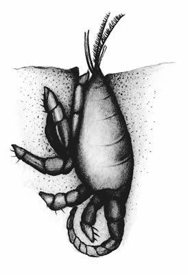
A small chimney of mud reveals the home of the nocturnal burrowing crayfish (Cambarus diogenes). Various breathing holes in the ooze may give away the burrows of the common clamworm, the soft-shelled clam, or the common jackknife clam. Less obvious are mud shrimp and snapping shrimp, which rarely leave their sometimes-deep burrows.
Opportunistic gulls, terns, and shorebirds such as the American Oystercatcher (Haematopus palliatus), semipalmated plover (Charadrius semipalmatus), and dunlin (Calidris alpina) may also appear at low tide. Gulls and terns scavenge on the surface, while shorebirds have beaks adapted for probing into the mud.
People swimming or playing in the bay or ocean at beach areas may have come to realize that what one day may seem an empty body of shallow water will another day be full of schools of fish bumping the legs, crabs underfoot, or even worse, stinging jellyfish or stinging nettles. Shallow waters of a few feet deep harbor a fluid mix of marine life, including organisms buried in the bottom, migrating fish and the predators that follow them, and a whole microscopic community of microscopic plankton that float with the currents.
Burrowing worms, clams, snails and other benthic organisms inhabit the bottom. Life forms vary according to depth, salinity, substrate composition, and vegetation, if there is any. Sunlight can usually penetrate to the bottom in shallow waters, so aquatic grasses may take hold, creating an entirely new habitat for marine biologists to study.
Grass beds in the bays shallow waters are known as submerged aquatic vegetation or SAV. The Chesapeake Bay has more than a dozen native species, including wild celery (Vallisneria americana), common waterweed (Elodea canadensis) and redhead grass (Potamogeton perfoliatus). Species vary according to salinity, among other factors. The wild celery is a freshwater species, while wigeon grass (Ruppia maritima) tolerates very brackish water and eelgrass (Zostera marina) can live in pure seawater.
SAV, perhaps more than any other plant community, is vital to the bays health, producing much-needed oxygen underwater just as trees do above ground. They also provide hiding places and food for marine life, as well as for migrating, wintering, and nesting waterfowl. The grass beds act as a filter, absorbing nutrients such as nitrogen and phosphorous, and their thick stands trap sediments that might otherwise settle on oyster beds.
Just as wild turkey or deer inhabit above ground forests, SAV beds harbor aquatic animals such as minnows and blue crabs. In saltier areas, barnacles and scallop larvae attach themselves to the leaves and stems of eelgrass. In fresher water in the bay tributaries, anglers know to cast to underwater grass beds for bluegill and largemouth bass. Tiny zooplankton that feed on the grasses are themselves food for larger organisms.
Sedimentation and a decline in water quality have taken a heavy toll on the Chesapeakes grass beds over the last several decades. Nutrients from car exhausts and power plant emissions can be carried for miles in air currents to settle in the bay. Governments have made good strides in curbing this point-source pollutionpollution that comes from an obvious source such as a smokestack or underground pipe. Finger pointing is easy when the pollution is so visible. Harder to get a handle on are the nonpoint sources such as fertilized farms and lawns, animal and human waste, and construction sites. Pollution from these sources runs off into streams or seeps into groundwater, often traveling many miles from the point of origin to reach the bay.
In smaller amounts, nutrients are a good thing. A healthy estuary is remarkably resilient and can even deal with excessive nutrients up to a point. Uncontrolled nutrient loading, however, causes algae bloom that clouds the water and blocks out sunlight necessary for the growth of SAV.
Only 11 percent of the bays historic underwater grasses remain. The loss of vegetation is one more factor in the decline or disappearance of many species that depend on the bay. An estimated 80,000 migratory redhead ducks, for instance, once visited the bay annually to feed on seeds, roots, and tubers in the grass beds. Only a few thousand redheads now stop each year.
An overall increase in grasses has encouraged biologists over the past few years, but its too early to tell if the trend will be long term. A reduction in nutrients is considered to be the primary reason for the resurgence in grasses. It is tempting to point to restrictions that have been put on industry and other point-source polluters as a factor in the nutrient reduction. However, the present increase in aquatic grasses has occurred during years of drought. Because the streams and rivers have been so low, they transported a much lighter load of nutrients. These nutrients build in the soils of the watershed, only to be flushed out in years of heavy rains.
For unknown reasons, the recent resurgence of underwater grasses did not benefit Tangier Sound on Marylands lower Eastern Shore. Grass beds there, which have played an important historic role in the health of the ecosystem, continue a serious decline. More than 60 percent of the sounds underwater grasses have disappeared in just seven years.
The reason humans have survived as a species, or so it has been postulated, is because they taste bad. Oysters, on the other hand, have been decimated because of their flavor.
The delectable oyster (Crassostrea virginica)so abundant at the time European settlers arrivedhas been largely wiped out. Much like the forests of North America that stretched as far as the eye could see when Lewis and Clark crossed the continent, oysters were once so abundant in the Chesapeake Bay they were imagined to be as eternal as the seas themselves. Reefs of oysters stacked upon oysters were so massive they were navigational hazards and appeared on maps.
These reefs, with live oysters living upon the heaped up empty shells of dead oysters, built into huge masses over thousands of years and were quite remarkable in their complexity. Examination of an oyster shell reveals the many bumps and ridges that greatly increase the surface area where other sessile creatures such as sea squirts, mussels, barnacles, anemones, and a variety of bryozoans can attach. These, in turn, provide food, hiding places, and nurseries for a variety of worms, crustaceans, fish, and the like.
Just as the American forests turned out to be finite after all when logging and mining operations of the nineteenth and early twentieth centuries left nothing but denuded, eroding hillsides, so too did oyster reefs turn out to have limitations. The worlds insatiable taste for the Virginia oyster invited non-restricted harvesting. Sediment-filled runoff from development within the bay watershed and pollution have taken their toll. Dredging the bottom to create deeper water for navigation has destroyed oyster bars or covered them with sediment.
In recent years, the oysters weakened immune system proved insufficient to battle two ravaging diseases caused by microscopic parasites known as MSX (Haplosporidium nelsoni) and Dermo (Perkinsus marinus), which are not harmful to humans. Although pathologists in the past five years have gained a much greater knowledge about the mechanisms the parasites employ in overcoming the oysters defenses, no progress has been made toward curbing their devastating effects on the oyster population.
Loss of habitat, sedimentation, dredging, disease, oxygen-robbing nutrients, and over-harvesting have reduced this important bivalve to less than one percent of its historic numbers. The living oyster opens its shell, drawing water filled with plankton and detritus along its gills to the mouth. Scientists say that at their peak, the oyster population of the Chesapeake could filter the entire volume of water in the bay in 3 to 6 days. Whether or not that is true, it is certain that the bay lost not only its economic mainstay, but also a significant filter for its waters when the oyster reefs were wiped out.
Although the once-expansive reefs are gone, oyster communities still exist in the bay where the bottom is firm enough and where siltation is not a problem. The location of these communities fluctuates with freezing waters, heavy freshwater runoff, and sedimentation, which oysters cannot tolerate. In the Chesapeake Bay, most oyster bars and clusters are located in the transition zone between tidal wetlands and open waters. Researchers with the Virginia Marine Resources Commission are also involved in promising experimental projects to build artificial reefs of oyster shells, which will enable oysters to establish colonies that are above the siltation and low oxygen in the bottom substrate. The new reefs are turning out to be fish attractants as well, a benefit that is getting the attention of the bays anglers.
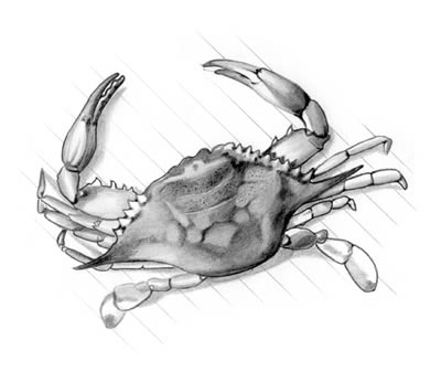
The blue crab is synonymous, in many minds, with the Chesapeake Bay. Travel brochures, menu covers, marina signs, and magazine articles on the bay are often adorned with a picture of this colorful, pugnacious crustacean.
The scientific name for blue crabsCallinectes sapideswas popularized with the Pulitzer-prize-winning book, Beautiful Swimmers, by William Warner. The crabs scientific name is derived from Latin and Greek. The genusCalli (beautiful) and nectes (swimmer)does translate to beautiful swimmer. Add the species name, sapidus (savory), and you have a savory, beautiful swimmer.
Like so much of life in the estuary, the life cycle of the crab is truly amazing. Mature male crabs spend their lives in the estuary. Most females migrate to the mouth of the bay in fall where they crowd together and spend the winter in semi-hibernation buried in the mud. Some females dont make the journey until the following spring, when they have to run the crab-pot gauntlet, as one scientist put it, to make it to their spawning grounds.
In spring, the females release some 2 million microscopic larvae called zoea (pronounced zoe-EE-uh) into the salty water. The larvae are carried into the ocean where they undergo many changes, molting and discarding their shells as they grow larger. They metamorphose to a form called a megalops, when they resemble tiny lobsters. After about two months of life at sea, they migrate back into the bay, continuing to molt, and become what is called a first crab, or immature crab.
Immature females undergo 18 or more molts before they are mature and ready to mate, which usually occurs during their second summer. The sperm they carry can live up to a year, fertilizing all the eggs the female will produce during that time. The egg mass, contained beneath the apron on the shell, has about 1.5 to 2 million eggs. As the eggs hatch, larvae are released over a period of two or three weeks. After two spawns, which take place from May to September, the female dies.
Males also continually molt, shedding their old shells as they grow larger. Unlike the female, which stops growing after mating, males continue to grow larger, molting and mating into the third summer.
The blue crab has filled the void in the commercial market left with the demise of the once-dominant American Oyster. Picking the meat from hard-shell crabs is a time-consuming task, so that "crab pickings," as they are called, have turned into social events. Friends gather around tables covered with brown paper or newspaper and spend an afternoon or evening feasting on plates of stacked-up crabs turned orange from steaming or boiling. Crabs have become so popular with diners that pressure is mounting to catch more and more of them by various methods, including crab pots, trotlines, and dredging the bottom.
Scientists are closely studying crab biology and trying to come up with better ways of monitoring the health of the population in the Chesapeake Bay. Many other species can be monitored by tagging, but a molting crustacean is a hard thing to tag. Annual surveys in the early-to-mid 1990s showed alarming declines, but various monitoring techniques turned up conflicting evidence, leaving scientists unsure about the true numbers. By all indications, the large grass beds that still remain in the lower bay seem to be critical to the survival of young crabs.
Along most of the shoreline of the Chesapeake, water depths do not exceed 10 feet. Between the subtidal shallows and the channels of the tributary rivers, the water is about 30 feet deep. Tributary rivers have gouged out channels of 60 foot depths or more, while the ancestral riverbed carved by the Susquehanna down the belly of the Chesapeake Bay is more than 100 feet deep for much of its length.
As the bay waters drop below 10 feet, less sunlight can penetrate to the bottom, and grasses disappear. Detritus from tidal wetlands and underwater grass beds is carried into deeper waters by the currents. Phytoplankton, those microscopic plants at the mercy of the currents, is the only plant life that exists in these deeper realms. Animal life that swims or floats with the currents includes jellyfish and the larvae and eggs of various fishes and invertebrates.
Swimming in the water column at various depths are the bay anchovy and the Atlantic silversidethe two most abundant baitfish in the Chesapeakealong with many larger fish. Charter boat captains spend lifetimes learning the habits and patterns of both migratory and resident fish in the Chesapeake Bay. In addition to feisty bluefish and striped bass, anglers seasonally catch flounder, gray trout, croaker, spot, red and black drum, tautog, and cobia. Even the habits and seasons of baitfish are important, because where there are minnows, menhaden, mullet, anchovies, shad, and herring, there also will be gamefish.
Deeper waters are a collection point for sedimentation, which creates a hostile environment for bottom-dwelling (benthic) invertebrates that are able to live in shallower water. Lower amounts of oxygen, especially during summer months, add to the inhospitable environment. However, certain fish such as flounder and croaker are well adapted to life as bottom dwellers. Flounder, also called flatfish or doormats, undergo a metamorphosis after they are hatched, with one eye rotating around to the same side as the other eye, and the swimming orientation changing to a horizontal position instead of a vertical position. The fish can lie on the bottom and cover itself with silt to hide and wait to ambush its prey.
Sooner or later, anyone who spends any time in Virginia or Maryland will spot a "Save the Bay" bumper sticker. The slogan has been popularized by the 83,000-member Chesapeake Bay Foundation, headquartered in Annapolis, Maryland.
The Foundation releases annual reports called State of the Bay, much like the President of the United States describes the State of the Union each year. The unions health is considerably better than that of the bay. Based on a rating of 1 to 100, with 100 referring to the state of the estuary that Capt. John Smith described in his explorations during the early 1600s, the current health of the bay is rated at 28, up 5 points from the 1983 all-time-low of 23. Stated another way, the bay now operates at roughly a quarter of its historic potential, according to the CBF, with dramatically fewer fish, crabs, oysters, waterfowl, underwater grasses, wetlands, and trees than in past generations. If the bay were a hospital patient, doctors would have stabilized the vital signs, but the patient would still be in intensive care.
The foundation has spelled out specific goals to be achieved by the year 2010 and the actions necessary to achieve the goals. Categories for improvementthe same ones analyzed in rating the bayinclude nitrogen and phosphorous amounts, dissolved oxygen, water clarity, toxics, wetlands, forest buffers, underwater grasses, resource lands, blue crabs, striped bass, oysters, and shad.
One of the CBFs objectives is to work to close the legal loophole that has allowed ongoing ditching and draining of wetlands, erasing restoration gains. The foundation is also encouraging enforcement of legislation and new laws that would protect and restore streamside buffers. Regulatory and monitoring systems on toxic chemicals are insufficient, as are erosion and sediment-control programs. Partnerships among state and federal resource agencies, private conservation groups, and citizens remain the best hope for accomplishing many of the foundations objectives. The CBF has challenged the partners of the Chesapeake Bay Program to adopt the goals and the action plans.
Following scientific research in the late 1970s indicating serious nutrient overloads, dwindling aquatic grasses, and toxic pollution, a partnership was formed called the Chesapeake Bay Program. Members include the states of Maryland, Pennsylvania, and Virginia; the District of Columbia; the Chesapeake Bay Commission, a tri-state legislative body; the Environmental Protection Agency, representing the federal government; and advisory groups. With the signing of the Chesapeake Bay Agreement in 1983, the partners agreed on a goal of reducing the nutrients nitrogen and phosphorous entering the bay by 40 percent by the year 2000.
The goal was not met by 2000, largely because of a loophole in a law that was designed to curb the drainage of wetlands. However, a ban on phosphate detergents in the late 1980s did result in a marked reduction in the amount of phosphorous entering the bay. The government partnership is also attempting to remove old dams and other barriers to fish migration, protect the bays eroding islands, restore wetlands, and create aquatic reefs.
The Environmental Protection Agency put the Chesapeake Bay on its "dirty waters list" in 1998 (Maryland portion) and 1999 (Virginia portion). The EPA says the bay and some of its tributaries are significantly low in dissolved oxygen, apparently because of excess nutrients that cause algae bloom, robbing the water of its oxygen. Until now, reduction of nutrients in much of the watershed has been left largely to voluntary efforts. The EPA listing puts teeth into environmentalists efforts to clean up the bay by requiring localities to foot the bill for better sewage treatment plants. However, no time line for devising a clean-up plan has been put in place.
Actually, theres a smidgen of good news mixed in with the bad. The good news is that the gradual decline in the overall health of the bay has been halted and, in some ways, actual gains have been made. There is less pollution, water quality is better, striped bass have made a remarkable comeback following a ban on fishing, and numbers of eagles and osprey are on the rise as a result of a ban on the pesticide, DDT. A ban on the use of detergents containing phosphorous has contributed to a decline in phosphorus loads delivered to the bay from all of its tributaries by 6 million pounds a year. Nitrogen loads have been reduced by 32 million pounds a year, but more needs to be done.
The bad news is that the bays health is still rated as poor. Also looming on the horizon are mounting pressures from the steadily increasing human population around the bay, urban growth in the watershed, and the continued loss of wetlands, forests, and open space that buffer and renew the bays waters. As one scientist put it, you can put all the pollution-control devices you want on the automobile, but if you drive more cars for more hours, youve still got a pollution problem.
Growth is not necessarily a bad thing, but people in the Chesapeake Bay watershed may need to make hard choices about continuing to allow unrestricted growth that may well destroy the estuary. At present, homes and businesses are haphazardly spreading across the landscape.
The estimated 2 to 3 million people who will be added to the watershed in the next few years will also bring more cars, more houses, more blacktop, and more sewage treatment plants, replacing the green spaces that are filters and sponges for the bay with hard surfaces, and adding to the industrial discharges and air pollution. Although some improvement has been made in the bays health through voluntary and regulatory actions, the fundamental message from environmentalists is that people must change the way they do things or risk losing the Chesapeake Bay.
Scientists say that sprawl produces from five to seven times the sediment and phosphorus as a forest and nearly twice as much sediment and nitrogen as compact development. Also, as lifestyles change, each person uses four to five times more land than he or she did just 40 years ago. More than 90,000 acres150 square milesof open land are consumed annually by growth in the bay watershed.
Even when legislators are convinced of the importance of cleaning up the bay, the laws passed often are not enforced or loopholes are found. The Chesapeake Bay Preservation Act was passed in 1988, requiring that communities adopt local ordinance restricting certain kinds of development activities along the Chesapeake Bay shoreline. On paper, it looked good. But the law turned out to be riddled with loopholes, including a clause that allowed planned development to be grandfathered in with the law.
Concerned citizens who care about their watershed can encourage their city, county, and state officials to develop master plans to guide land use and provide for more compact growth. Organizations like the Chesapeake Bay Foundation have ideas to assist communities and information that can help allay fears that such land use plans might curb their freedoms or that their tax bases might be destroyed if they fail to attract more industry.
Loss of habitat is one of the major obstacles to restoring the bays health. Maryland has lost approximately 73 percent of its original wetlands, Virginia has lost more than 42 percent, and Pennsylvania has lost 56 percent. The trend has slowed in recent years, but losses continue to be significant. Less than 60 percent of the original forests of the watershed remains today. Underwater grasses once covered most of the bay floor. After being reduced to just 11 percent of their historic levels, they have begun to make a comeback in recent years.
In 1999, a marine science professor at the Virginia Institute of Marine Science documented a 71-percent decline in the number of breeding-age female crabs in the bay in just 10 years. An official with the Virginia Marine Resources Commission fears the crab population may be on the brink of a collapse. Virginia and Maryland are considering the professors proposal to create a corridor where no crabbing would be allowed between the crab spawning area at the mouth of the bay and the crab nursery area in selected shallow waters of the middle bay and upper bay. However, pressure from watermen desperate for income creates a dilemma. License agencies must decide whether or not to issue more "hardship licenses" that have already resulted in thousands of additional crab pots in the bay.
Cattle that stand belly deep in farm ponds and hogs that make muddy paths on stream banks are bad news for the Chesapeake Bay. Animal waste and stream bank erosion add to the nutrient load and sedimentation. Virginia is now paying farmers to fence their livestock away from streams and rivers. Another law directed at agriculture is a restriction on fertilizing crops with chicken manure in amounts too great for the crops to absorb. However, no restrictions are in place for golf courses, private homeowners, and many other sources of nutrient runoff.
Recovery prospects are not hopeless. As scientists gain an understanding of the complex workings of the estuary, they are better able to recommend solutions to reverse the loss of wetlands and forestlands, revive oyster beds, encourage the growth of bay grasses, and curb urban sprawl and pollution. Given the high human density in the Chesapeake Bay watershed, the rating of 100 is a thing of the past. But in a half-century, if determined measures are taken by the six states that share the watershed, researchers say that a rating of 70 is a reasonable expectation.
It may be helpful to remind ourselves that the bays decline is a recent crisis. The Chesapeake we are trying to return to is still in the memory of those who fished its water for striped bass or dug their toes in its muck for clams just 40 or 50 years ago. Humans, of all species, would benefit greatly from its restoration. Why pay high dollars for more and larger filtration systems, for example, to do what a vibrant estuary will do for free?
Given the assaults on the bay from pollution, rising sea levels, loss of habitat to development, and other sources, focusing on the bays wonders is not always easy. As important as it is to understand what measures should be taken to restore the bays health, it is also important to enjoy the ecosystem for what it is.
Birds migrating along the Atlantic Flyway still feed and rest in the salt marshes, sandpipers still probe the mud flats, and great blue herons find secluded woodlands for their rookeries. Rod-bending red and black drum still tax the endurance of surf anglers, and children still scream in delight when they net their first blue crab. The tides still ebb and flow, renewing entire ecosystems with each change.
For all its problems, the Chesapeake Bay is still a marvelous place.
Read and add comments about this page