[Fig. 30(29)] The Nolichucky/Unaka Ranger District headquarters in Greeneville should be your first stop for information and maps of the district. A rack contains brochures, maps, and other useful information about the area. This is the southernmost of the two ranger districts of the northern Cherokee National Forest (CNF).
There are about 170,000 acres in the Nolichucky/Unaka Ranger District located in Cocke, Greene, Unicoi, and Carter counties. Primitive camping is allowed anywhere in the district year-round unless areas are otherwise designated. There are over 250 miles of trails, including 30 miles of horse trails and 24 miles of trails for ATVs and motorcycles. There are two designated swimming areas, 13 picnic areas, fishing opportunities on the Nolichucky River, French Broad River, and other streams, and hunting in the Cherokee Wildlife Management Area. Allen Branch Pond is a barrier-free fishing pond with a 0.25-mile interpretive trail. Black bear, white-tailed deer, ruffed grouse, and wild turkey are the most popular game species. To be safe, check with the Nolichucky/Unaka Ranger District before hiking during bear season in November and December—the time of organized hunts with dogs.
Stocked trout streams in Greene County are Horse, Paint, Middle Camp, and Cove creeks. In Cocke County the trout streams are Gulf Fork and Trail Fork creeks. Special regulations apply on many trout streams, and these may change from year to year. For a current issue of regulations, be sure to check with the Tennessee Wildlife Resources Agency, 6032 W. Andrew Johnson Highway, Talbott, TN 37877. Phone (423) 587-7037 or (800) 332-0900.
Possibly the most popular water sport in this part of the forest is whitewater rafting on the Nolichucky, Pigeon, and French Broad rivers (see Appendix XX for a list of guides and outfitters). The Nolichucky/Unaka Ranger District maintains the French Broad Boating Site on TN 25, 5 miles east of Del Rio. This site provides carry-down access to the river.
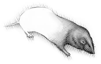
Songbirds in this ranger district include the tufted titmouse (Parus bicolor), red-eyed vireo (Vireo olivaceus), acadian flycatcher (Empidinax virescens), and blackburnian warbler (Dendroica fusca). The pine vole (Microtus pinetorum), muskrat (Odontra zibethicus), red fox (Vulpes vulpes), gray squirrel (Sciurus carolinensis), fox squirrel (Sciurus niger), southern flying squirrel (Glaucomys volans), northern flying squirrel (Glaucomys sabrinus), queen snake (Regina septvittata), spotted salamander (Ambystoma maculatum), slender glass lizard (Ophisaurus attenuatus), and painted turtle (Chrysemus picta) are among the rich fauna living in this district.
As with the fauna, the Nolichucky/Unaka Ranger District contains much the
same flora as the other ranger district in the northern Cherokee National Forest:
trillium, pink and yellow lady's slippers, foamflowers, solomon's
seal (Polygonatum
biflorum), hemlocks, oaks, pines, buckeye, mountain laurel, rhododendron,
and flame azaleas.

[Fig. 31] Roan Mountain, known locally as The Roan, is one of the best-known mountains in the Unakas, and the state park, located just under the mountain's 6,285-foot peak, is one of Tennessee's most visited.
The park contains 2,006 acres of the approximate 14,500 acres of Roan Mountain, and efforts are under way to acquire more acreage to protect the unique features found at this location. In the state park and the portion administered by the U.S. Forest Service, The Roan boasts over 600 acres of Catawba rhododendron, the largest rhododendron garden in the United States, and there are 10 miles of grassy balds stretching from Carver's Gap on Roan Mountain north to Big Hump Mountain, which also display the beauty of the blooming rhododendrons in June. Roan Mountain is one of the very few areas east of the Rocky Mountains where igneous, or volcanic rocks are found. The rocks are called Roan Mountain Gneiss.
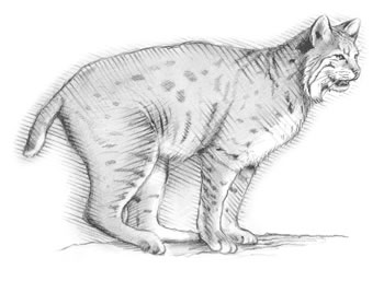
Upland slopes of The Roan are covered with oak, hickory, hemlock, black birch (Betula lenta), and yellow buckeye (Aesculus flava), with Fraser fir and red spruce at the highest elevations. There are more than 180 species of wildflowers in evidence from spring to fall. Deer, foxes, bobcats, skunks, owls, chipmunks (Tamias striatus), and an occasional bear may be seen, as well as an abundance of songbirds.
Roan Mountain is one of the only cross-country skiing state parks in the South, with three trails that total 8.5 miles designated for cross-country skiing. There is no ski lodge or lift, and skiers must bring their own equipment.
Camping is permitted in the campgrounds only. There are no backcountry campsites in Roan Mountain State Park.
[Fig. 30(18)] "This management area on Roan Mountain contains some of the most unique flora and fauna in the eastern United States. Much national attention has been directed to identifying and classifying these unique features as well as being recognized for its outstanding scenic qualities of high mountain balds, rhododendron gardens, and spruce-fir timber types…This area is unsuitable for timber production," says the CNF 1988 Management Plan for this area.
Roan Mountain forms an independent portion of the Unaka Range called the Roan Mountain Massif. It contains more than 300 species of plants, some rare and endangered, and wildlife, some at their northern and southern limits.
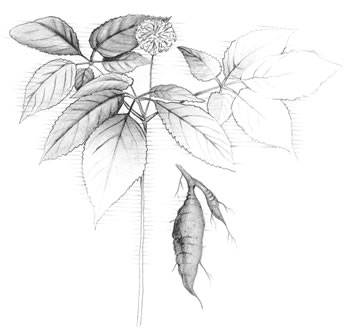
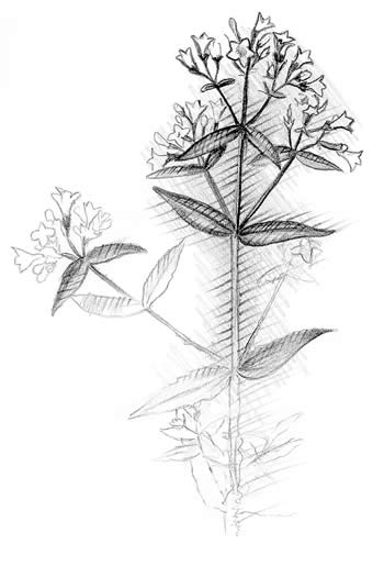
The balds in this area attract visitors in the spring to see wildflowers bloom. Flowers here include white fringed phacelia (Phacelia purshii), mayapples (Podophyllum peltatum), white and purple violets (Viola primulifolia and V. papilionacea), trout lilies (Erythronium americanum), hawkweed (Hieracium sp.), ragwort (Senecio sp.), flame azaleas (Rhododendron calendulaceum), and extensive areas of Catawba rhododendron, which are considered the most beautiful in the world. Gray's lily (Lilium grayi), Blue Ridge goldenrod (Solidago spithimaca), Roan Mountain bluet (Houstonia purpurea var. montana), and spreading avens (Geum radiatum) are among the rare plants living on the massif.
A yellow birch tree (Betula alleghaniensis) found in the hardwood forest
was determined to be 385 years old. Dwarf beeches near the edge of a bald were
dated at 250 years old but are only 12 inches in diameter. They grow so slowly
because they are in a marginal area with harsh conditions. Two other unique
species in the area are the dwarfed yellow buckeye and table
mountain pine (Pinus pungens). Also, very old lichens grow among the rocks. Growing
at a rate of 0.063 of an inch every quarter-century, some are reported to be
centuries old.
The 18-mile Highlands of Roan ridge, influenced by topography, altitude, latitude, and the glaciers, is home to an unusual mix of wildlife. The last ice age forced some animals, such as the Appalachian cottontail (Sylvilagus obscurus) and the Southern bog lemming (Synaptomys cooperi), south from their former habitats. The warming period that followed the last glaciation made this area hospitable to some animals that were living farther south, and they migrated north. Some of these animals were the opossum and southern flying squirrel (Glaucomys volans). These new migrants found their niche among the local populations of bears, bobcats, skunks, foxes, owls, and mice and remain here today.
There are trails on the Highlands of Roan Ridge, which is partially in North Carolina, with the AT being the most popular. The 17 miles of the AT that traverse this area are considered the most beautiful of all 2,100 miles of the AT from Georgia to Maine. In the U.S. Forest Service Composite Plan for the Highlands of Roan it says, "There is no other area…that offers such extensive panoramic views of the high mountain country of the southern Appalachians. Unique is not, at least in this sense, misleading."
The AT crosses the Highlands of Roan, the high and grassy Round and Jane balds, and five mountain peaks above 5,400 feet elevation, including Roan High Knob (elevation 6,285 feet), Little Hump Mountain (elevation 5,549 feet), and Big Hump Mountain (elevation 5,587 feet).
[Fig. 30(19)] The Twin Springs Picnic Area offers a secluded spot in the woods for a picnic away from the highly visited Roan Mountain State Park.
[Fig. 30(20)] Roan High Knob and Carver's Gap are beyond Roan Mountain State Park on TN 143. Carver's Gap is 8 miles from the park and is an obvious gap. The Tennessee/North Carolina border and the AT pass through here, and hikers may access the AT here. There is a lovely picnic area across the state line in North Carolina's Pisgah National Forest.
You may want to see the Rhododendron Gardens in North Carolina's Pisgah National Forest. From Carver's Gap, turn right on FR 130 toward Roan High Knob and the dense area of rhododendrons. At the end of FR 130 are picnic tables, restrooms, a parking lot, and an information station (open during the rhododendron bloom in May and June). From the parking lot, the Cloudland Trail (see below) begins to the southwest and passes parallel to the road.
[Fig. 30(21)] The Cloudland Trail in North Carolina begins at the parking lot at the end of the paved road FR 130, and leads to a marker where the Cloudland Hotel once stood. In 1885, John Thomas Wilder, a Union general, built a three-story, 166-room hotel here at an elevation of 6,150 feet. The hotel had only four baths. The hotel straddles the Tennessee/North Carolina border. It was so designed to accommodate the drinking of alcohol in the Tennessee end of the hotel. North Carolina was dry at the time.
Railroad tracks were laid from valleys in Tennessee and North Carolina over the mountain to get building materials to the site. Cables connected railroad cars on opposite sides of the mountain; a weighted car on top would go down the mountain, thereby pulling up the car loaded with supplies from the opposite bottom. Supplies were sent up from both states. The hotel was abandoned in 1910.
[Fig. 32, Fig. 30(1)] The Unaka Mountain Wilderness Area consists of 4,700 acres in Unicoi County, with its highest point at 4,840 feet at Overlook and its lowest point at 2,600 feet at Timber Trail Branch. The wilderness area is on the north side of Unaka Mountain. The mountain peaks at 5,180 feet and gives its name to the quartzite, Unaka Mountain Quartzite, found on the peak. Its geology is similar to that of the Unaka Range. Unaka Mountain, like most of the CNF, was logged during the early 1900s. Scars from fires in 1925 have healed nicely, and the fire scars of 1978 are well into the healing process.
Of the many waterfalls in the area, Rock Creek Falls is pretty and accessible,
but reaching it requires four creek fordings and crossing water up to 2 feet
high or more during wet seasons. Large Eastern hemlocks, heath balds, dense
upland hardwoods, red spruce at higher elevations, and ridges with spectacular
views make trekking through this wilderness a delightful experience. Fraser's
sedge (Dichromena sp.), Mitchell's St. John's wort (Hypericum sp.),
rattlesnake root, gentian (Gentiana sp.), and mountain mint (Pycanthemum
incanum) are some of the plants on Unaka Mountain. Wildlife includes bear,
deer, grouse, fox, birds, and reptiles common to the CNF.
[Fig. 30(2)] The Unaka Mountain Scenic Area contains 910 acres. It is contiguous with the Unaka Mountain Wilderness Area at the southwestern end of the wilderness and shares the same flora, fauna, geology, and history.
[Fig. 30(3)] This automobile tour is a 30-mile loop from Erwin through Unicoi County and around the Unaka Scenic and Wilderness areas with stops along the way. Beginning in Erwin, drive north on Main Street and turn right (southeast) on TN 395 (Rock Creek Road) toward the Rock Creek Recreation Area.
The following 14 listings are on the auto tour loop.
[Fig. 30(4)] Rock Creek Recreation Area at the foot of Unaka Mountain has camping accommodations in a beautiful cove. The Civilian Conservation Corps (CCC) began this as a day-use area in the 1930s, and it was expanded to include camping in the 1960s.
Today, camping and picnicking are available on a first-come first-serve basis. Visitors come here to enjoy the clear, cool water of the swimming area. This area puts campers in a great location to explore Unaka Mountain with the added convenience of nearby Erwin.
[Fig. 30(5)] The Rock Creek Falls Trail (#148) begins above Loop C in Rock Creek Recreation Area and travels to Rock Creek Falls. One of the outstanding falls in the area, Rock Creek Falls is a tiered falls that drops about 50 feet from overhanging cliffs.
The trail is a wilderness trail that requires fording four creeks and crossing water at least 2 feet high during wet seasons.
[Fig. 30(6)] Rock Creek Bicycle Trail (#178), an easy trail for all ages, begins opposite Loop B in Rock Creek Recreation Area and ends at Loop C.
[Fig. 30(7)] Hemlock Forest Trail (#179) is a short loop trail beginning
at Rock Creek Recreation Area amphitheater. This is an easy walk through a
charming woodland setting.

[Fig. 30(8)] From Rock Creek Recreation Area, drive south 3 miles to Indian Grave Gap. TN 395 becomes FR 230. According to local history, this area takes its name from a battle fought here in the 1700s between Indians and settlers. According to the legend, some of the Indians were buried near here, but no evidence has been found.
On the ridgetop it is possible to put one foot in the Pisgah National Forest, North Carolina, while keeping one foot in the Cherokee National Forest, Tennessee. From here the famous Appalachian Trail that runs from Maine to Georgia follows the ridgetop.
This is a scenic viewing area.
[Fig. 30(9)] Beauty Spot is about 2 miles farther along FR 230. Grassy openings like this are called balds due to their lack of trees. No one knows exactly what causes balds, but theories include over-grazing by cattle in the eighteenth century, severe forest fires, and feeding buffalo herds in the seventeenth and eighteenth centuries that may have trampled existing vegetation. Beauty Spot's grassy bald is mowed to prevent shrubs like huckleberry (Vaccinium arboreum), hawthorn (Crataegus sp.), and laurel from encroaching and covering the bald.
The grassy meadows here provide habitat for a variety of animals including deer, rabbits, voles, mice, hawks, owls, foxes, grouse, and many species of songbirds. This is one of the best places to take panoramic photos, as are the next two stops.
This is a scenic viewing and wildlife viewing area.
[Fig. 30(10)] Beauty Spot Gap, about 5 miles farther along the drive at an elevation of 4,500 feet, attracts many visitors who come to see wildflowers. Updrafts of wind along the steep mountainside bring thousands of seeds to this area on this side of Unaka Mountain. This area is a microclimate with much fog. The rich and moist soil provides an ideal habitat for trillium, spiderwort (tradescantia virginiana), coreopsis (Coreopsis sp.), whorled loosestrife (Lysimachia quadrifolia), bluebead lily (Clintonia borealis), and many other wildflowers.
Near here is believed to be an old silver mine. Many people have searched unsuccessfully for the lost mine that a prospector worked. He traveled on foot through the villages below the mountain en route to his secret mine. It is said that he always returned with some silver. If the mine has been rediscovered, it has been kept a secret.
This is a scenic viewing area.
[Fig. 30(11)] Continue for 3.5 miles to the Unaka Mountain Overlook. The elevation here is nearly 1 mile high. Look 28 miles to the southeast to see Mount Mitchell in North Carolina, the highest mountain east of the Mississippi at 6,684 feet. To the right is Erwin where this tour began. Below is Beauty Spot Gap and farther out lies Beauty Spot.
This is a scenic viewing area.
[Fig. 30(12)] For the next 2 miles, the drive passes through a spruce forest. Many evergreens on Unaka Mountain are red spruce. Spruce forests are dense, and sunlight cannot penetrate them. As a result little groundcover grows here, and the forest is usually cool and moist. These conditions create habitat for unique wildlife species including the lungless Appalachian salamander (Plethodon jordani). Instead of laying their eggs in water like most amphibians, they use the moist forest floor. The forest also provides habitat for endangered species such as the northern flying squirrel (Glaucomys sabrinus).
[Fig. 30(13)] Continue for 3.5 miles to see a white pine plantation on the
north side of the road. The CCC planted the white pines in the 1930s. A fire
burned this area in 1925 destroying most of the trees and vegetation. The replanting
efforts were successful, and the area is once again a productive forest. The
remains of an old railroad grade are visible to the left of the curve. The
railroad was constructed in the early 1900s to haul logs from here to sawmills
in the valleys below. There are no fences, and this is a pretty place to walk
through the trees.
This is a scenic viewing and wildlife viewing area, and there are no trails here.
[Fig. 30(14)] Another 1.4 miles ahead is Clear Fork Creek. The U.S. Forest Service and the Tennessee Wildlife Resources Agency joined forces to enhance brook trout habitat by building fish barriers (waterfalls) like the one here. They help the native brook trout by keeping nonnative rainbow trout from traveling upstream to where brook trout live. Rainbows, a highly competitive fish, compete for food and habitat of brook trout, a less competitive fish that prefers the cooler, upper sections of mountain streams.
This is pretty creek, but not exceptional. The main features here are the fish barriers and a rare flower, the large round-leaved orchid (Platanthera orbiculata). There are no trails here.
[Fig. 30(15)] From Clear Fork Creek continue to TN 107 and turn left (west). Just beyond the county road entering from the right (north) is Bell Cemetery in the community of Limestone Cove. This is a Civil War cemetery. The area is known for its Civil War history and for being the place where Andrew Jackson first entered Tennessee. He rode through Limestone Cove on his way to the state's first town, Jonesborough, to establish his law practice. This is a good place to see deer, bear, and turkey.
[Fig. 30(16)] About 1.5 miles farther down TN 107 is Limestone Cove Recreation Area. It offers primitive camping at the northern end of Unaka Mountain, east of the town of Unicoi. This 18-unit campground was built in the 1960s and offers a relaxed atmosphere. Playing in the creek and fishing for rainbow and brown trout are favorite activities of children and adults alike.
[Fig. 30(17)] Continue on TN 107 for about 7 miles through the town of Unicoi to the Erwin National Fish Hatchery and Unicoi Heritage Museum. Congress made provisions for this fish hatchery in 1894, and it was established in 1897. The U.S. Fish and Wildlife Service operates it. Several strains of rainbow trout and fertilized eggs are produced here, and the hatchery supplies brood trout and eggs to other hatcheries, research facilities, and other countries. Brood fish weigh between 3 and 6 pounds. More than 18 million eggs are shipped each year. Viewing is allowed in a few raceways and indoor tanks. There are nature trails that go by ponds on the 30-acre area.
Streams stocked with trout in the Nolichucky/Unaka Ranger District include South and North Indian, Coffee Ridge, Rocky Fork, Spivey, and Clarks creeks.
The Unicoi County Heritage Museum, once scheduled to be razed, was saved through the efforts of concerned citizens. This beautiful Victorian-style house built in 1903, once the home of the superintendent of the hatchery, is used to display artifacts and exhibits that interpret local history from Indian times, through the Civil War, to the beginning of the twentieth century. Next door is Erwin City Park with swimming pool, tennis courts, and ball parks.

[Fig. 33] The Nolichucky River's churning whitewater winds through one of the deepest gorges in the eastern United States. The gorge is 2,600 feet deep. Its steep slopes and rising cliffs provide spectacular scenery. A railroad track lies along the southern side of the river, but there are no maintained trails in the gorge. Hikers are welcome to explore on their own, and there is good smallmouth bass fishing here.
U.S.A. Raft (see Appendix C), a commercial rafting company on the river, is one of the outfitters that operates where the road ends after turning right (south) at the Nolichucky Bridge. The company offers shuttle service, cabins, and camping. Rafters are shuttled to Poplar, North Carolina, for a day-long trip down the Nolichucky River.
For more information: U.S.A. Raft/Nolichucky Campground, Box 2 Jones Branch Road, Erwin, TN 37650. Phone (800) USA-RAFT or (423) 743-7111.
[Fig. 34] The Sampson Mountain Wilderness Area consists of 8,319 acres in Unicoi, Greene, and Washington counties, in the Nolichucky/Unaka District, with its highest elevation of 4,060 feet on Sampson Mountain and its lowest elevation of 1,780 feet on Cassi Creek. Scenic views and Buckeye Falls are the drawing cards to this wilderness.
Buckeye Falls, about 700 feet, is touted as the tallest waterfall in the eastern United States. Painter Creek Falls is an impressive 200-foot waterfall but is difficult to reach. Neither of these are true waterfalls but are cascades. A cascade is a series of small waterfalls whereas a waterfall is one vertical drop.
Timber dating to 1800 exists in the wilderness area, and in fact, there are 536 acres of trees here that are over 100 years old. But much of the area was logged prior to National Forest wilderness designation in 1986. Much of the timber was cut in the 1930s, and fires since then have left scars. Scars from the large fire of 1952 have healed, but scars from the 1981 fire that burned 1,600 acres along Painter Creek are still healing. No timber harvesting is allowed in wilderness areas.
Among the second-growth timber are wildflowers including showy orchids (Galearis
spectabilis), foamflowers (Tiarella cordifolia), yellow lady's
slipper (Cypripedium calceolus), bloodroot (Sanguinaria canadensis),
alumroot (Heuchera villosa), and a species listed as threatened in
Tennessee, turkeybeard (Xerophyllum asphodeloides).
[Fig. 34(3)] Buckeye Falls is reached by hiking along the Clark Creek Trail (no Forest Service number) with its trailhead at the end of Clarks Creek Road (County Road 25) at a barrier. Walk along Clark Creek. You will see a sign marking the wilderness area. Continue along the creek and look for arrows, "BF," or other markings on rocks and trees. The last 0.4 mile is described as grueling.
This waterfall is cited as a 500- to 700-foot falls, but Buckeye Falls is actually a cascade with a horsetail form. During dry weather there is no falls, and in winter there are several hundred feet of walls of ice down the cliffs.
[Fig. 34(2)] The Painter Creek Trail (no Forest Service number) only goes for 1.1 miles, but Painter Creek Falls is another 1.25 miles farther upstream. The trail beyond the mile mark has stretches that are difficult to maneuver due to thick rhododendron. Switching from one side of the stream to the other makes walking easier in places. The trail ascends steeply at the 200-foot falls. If you want to continue upstream, the right side of the falls appears to be the best route, but be very careful. At least two people who have fallen here have died.
Painter Creek Road turns south off TN 107 leading into the wilderness area. There is a small parking area just before the road ends at a gate blocking vehicles from entering the wilderness area. The parking area is on private land and permission must be obtained to park there. Walk along the road beyond the gate for 0.2 mile, and then turn left on the trail.
[Fig. 33(3)] Horse Creek Recreation Area, one of the most popular of the recreation areas in the Nolichucky/Unaka Ranger District, offers fishing, swimming, picnicking, and camping. At an elevation of 1,720 feet, the area is nestled into a hardwood cove on Horse Creek.
This recreation area is popular with swimmers, picnickers, and campers. A mountain stream feeds the swimming hole. There is one 0.2-mile trail in the recreation area, but several longer ones are nearby.
From May 1 to September 30, Horse Creek is under special fishing regulations.
Only disabled persons, children 12 and under, and senior citizens (65 years
old or older) are allowed to fish for a two fish limit. Upstream from the recreation
area at the junction of Squibb Creek and Horse Creek, fishing is open to all.
[Fig. 33(2)] Bald Mountain Ridge Scenic Area, 8,653 acres in Greene County in the Nolichucky/Unaka Ranger District, is southwest of and adjacent to the Sampson Mountain Wilderness Area. Bald Mountain Ridge Scenic Area has been one of the most popular area in the Nolichucky/Unaka District for a long time with the locals, and its popularity is growing. It has 14 trails and balds on Cold Spring Mountain. Nearby recreation areas, Horse Creek and Old Forge, offer picnicking, swimming, and camping.
Greystone Mountain rises to 3,240 feet, Round Knob ascends to 3,280 feet, and Bald Mountain reaches 3,000 feet, providing some spectacular views. Another source for scenic views is Blackstack Cliffs on the Appalachian Trail (AT) between Jones Meadow and Big Butt, which soars to 4,838 feet. Photographs from these peaks taken with a 200mm lens or larger can rekindle memories of your visit for years to come.
Even though this scenic area has many trails, they are not hiked often; therefore, anyone seeking a wilderness experience can find it here. Hiking along these trails is not easy because many are not marked or maintained. In fact, hikers should have topographic maps of the area with them due to the rugged terrain. Of the 14 trails totaling about 29 miles (not including the AT) in the Bald Mountain Scenic Area, one of the most scenic and shortest, the 0.6-mile Marguerite Falls Trail (#189), leads to one of the best waterfalls in the area, Marguerite Falls. The longest trail, the Horse Creek Trail (#94), leading to the top of Cold Spring Mountain, runs 4.7 miles and is open to four-wheeling.
Mountain bicycles may use forest trails designated for that purpose, all forest development roads, and areas behind gated forest roads that are closed to motorists. The Doctor's Ridge Trail (#194), Poplar Cove Trail (#22), Cowbell Hollow Trail (#24), and Cold Spring Mountain Road (FR 5094) are the most popular mountain bicycling routes in Bald Mountain Ridge Scenic Area. FR 5094 accommodates ATVs and other off-road vehicles. Street-legal motorcycles and four-wheel-drive vehicles are allowed on open forest roads, but they must be equipped with spark arresters. Unlicensed motorcycles, four-wheel-drive vehicles, and three- and four-wheelers are not allowed on forest roads. These policies are enforced to prevent resource damage, to minimize conflict with other forest users and resources, and to comply with Tennessee state law. Horses and bicycles may be ridden on many roads, both open and closed to motorists.
Timber companies denuded this area in the pre-1930s, but the forest has recovered. The high ridges, such as Round Knob, are covered in oak forests. Cove hardwoods fill the hollows. Blueberry, rhododendron, and flame azalea abound on the southern slopes of Reynolds Ridge, Green Ridge, and Greystone Mountain. The thick vegetation is home to game animals and other forest wildlife. There are more than 200 acres of open land for wildlife that are closed to vehicles.
[Fig. 33(4)] Horse Creek Trail is also FR 94, which is open to four-wheel-drive vehicles, off-road vehicles, three- and four-wheelers, and motorcycles. Because it is extremely rough, you may choose to bike, hike, or ride a horse instead of hiking. The trail begins at the end of the paved road at Horse Creek Recreation Area and ends at the parking area near the top of Cold Spring Mountain for a distance of about 4.75 miles. There is a day-use fee at Horse Creek Recreation Area.
At the end of Horse Creek Trail is a junction with the AT, which provides access to Big Butt Mountain and other trails in the Bald Mountain Ridge Scenic Area. (Remember the AT is a trail for foot travel only.) The views from Big Butt, a grassy bald, are worth the walk and the bald is a good place to camp.
At the junction with the AT, a right (southwest) turn leads to the Sarvis Cove Trail (#14) in 0.2 mile and the grassy bald on Cold Spring Mountain. The balds on Cold Spring Mountain are good examples of typical grassy balds found in the southeastern United States, and offer views of the Appalachian Mountains to the southwest. These balds are also good camping sites.
The Sarvis Cove Trail (#14), a trail roughly following Sarvis Creek, is a good way to return to the Horse Creek Recreation Area. Although the trail is not managed, it has yellow, sometimes difficult to see, blazes. The Sarvis Cove Trail is 2.9 miles long to where it joins the Poplar Cove Trail (#22), a hiking and horse trail that is 2.8 miles long. The Poplar Cove Trail goes downhill from an elevation of 4,560 feet via a dozen switchbacks and through dense hemlock forests to rejoin the Horse Creek Trail just above the Horse Creek Recreation Area. Along Sarvis Creek are a small waterfall and cascades. Wildflowers make a splash in the spring under the hemlocks, rhododendrons, and mature hardwoods. The forest becomes younger farther down the mountain.
[Fig. 33(7)] Petes Branch Falls is only worth the walk following a recent rain or during a wet season. But use caution after a heavy downpour because there are several fords to negotiate. The double, fan-tailed waterfalls drop 45 feet through a quartzite cleft in an impressive bluff. Mature poplar, hemlock, and buckeye surround the area.
[Fig. 33(5)] The easy and wide Jennings Creek Trail (#21) begins at the south end of the Old Forge Recreation Area, crosses Jennings Creek, and passes by the swimming hole at the bottom of a falls. Look for a carved stone that says it's 2 miles to Round Knob Picnic Area to the right, but stay on this trail. When returning, you will come back along the trail to the right, which is the Little Jennings Creek Trail.
During the last of April and first of May, wild iris, foamflower, and white trillium bloom abundantly about 0.7 mile along the trail. Buckeye, poplar, hemlock, dogwood, and sugar maple shelter the creek and trail.
The Jennings Creek Trail leads to the Cowbell Hollow Trail (#24) that climbs 1.4 miles from the creek up Round Knob. Mountain bikers looking for a challenge may also use the Cowbell Hollow Trail. At the beginning of the trail the forest is much like that along Jennings Creek, and then as the altitude increases, the forest changes to red maple, oak, pine, rhododendron, and mountain laurel with an understory of wintergreen, trailing arbutus, and galax.
[Fig. 33(9)] Cowbell Hollow Trail ends at Round Knob Picnic Area where there are picnic tables, toilets, and a large pavilion with a stone fireplace. The Civilian Conservation Corps built the shelter during the 1930s. From here it is 2.1 miles back to the Old Forge Recreation Area down the Little Jennings Creek Trail (#195), also called the Round Knob Branch Trail. Round Knob is at an elevation of 3,280 feet, and the northwesterly walk back to the Old Forge Recreation Area is mostly downhill to 1,920 feet elevation where the trail joins the Jennings Creek Trail. The Little Jennings Creek Trail is also a horse and bike trail.
Those looking for wildflowers will enjoy a spring hike to see wild iris, trillium, showy orchids (Galearis spectabilis), jack-in-the-pulpit (Arisaema triphyllum), false solomon's seal, solomon's seal, and wild ginger (Asarum canadense).
Heart leaf, another name for wild ginger, blooms from April through May. Its heart-shaped leaves hide the brown flower called little brown jugs or little pig's feet. Indians boiled the root, claiming the tea was an oral contraceptive. Pioneer women used it as an analgesic to ease the pains of childbirth. The plant has proven to contain chemicals that are effective antibiotics. When the root is cooked with sugar, it is used as an alternative for ginger.
[Fig. 33(8)] Marguerite Falls, one of the most outstanding features in the Nolichucky/Unaka Ranger District, is fan-shaped and drops about 50 feet, cascading over stair-step rocks. The Marguerite Falls Trail (#198) rises about 500 feet through hardwoods and a gorge with sandstone cliffs, and just before reaching the falls, it offers a good view of Cathedral Rock—an impressive projection from the cliffs.
The Tennessee Wildlife Resources Agency, Trout Unlimited, and the U.S. Forest Service are working to restore brook trout in this stream, the West Fork of Dry Creek.
[Fig. 33(6)] Old Forge Recreation Area offers a lovely 5-mile walk on the Jennings Creek Trail Complex (Jennings Creek Trail [#21], Cowbell Hollow Trail [#24], and Little Jennings Creek Trail [#195]) to see wildflowers in spring and to Round Knob. On a 1.5-mile hike along the pretty Jennings Creek Trail (#21) are trailing arbutus, several violets, iris, and trillium that attract wildflower-seekers in the spring. Horseback riders and mountain bikers are welcome to use this trail too.
[Fig. 33(10)] The Paint Creek Corridor is a 5-mile stretch between the Paint Creek Campground in the Paint Creek Recreation Area and the French Broad River. While scenic driving is a popular activity along FR 41, the road running along the corridor, bicycling and horseback riding are becoming more common.
At one end of the corridor is Paint Creek Recreation Area, nestled in a mountain cove along Paint Creek and featuring campsites shaded by rhododendron, hemlock, and laurel that offer streamside views.
Paint Creek provides two interesting falls that you can drive to, Kelley Falls and Dudley Falls. Swimming, wading, and fishing for stocked and wild trout are popular activities at Paint Creek.
Kelley Falls drops about 20 feet over the face of bedrock spanning about 50 feet, forming a block, or rectangular-shaped falls. Get to these falls by driving 0.5 mile from Moses Bend Picnic Area along Paint Creek on FR 41 and parking at the turnout. Kelley Falls is a short walk downstream.
Dudley Falls drops from a constricted width in Paint Creek about 12 feet into a punchbowl. This pool is suitable for swimming, but warning signs are posted to keep daredevils from jumping from the cliffs. Get to this waterfall by driving 2.5 miles from Moses Bend Picnic Area on FR 41 and parking in the signed lot.
[Fig. 44(20)] Hikers and campers are attracted to this scenic site near the top of Round Mountain. In the summertime it is a naturally air-conditioned spot to pitch a tent or park a trailer. At 3,100 feet it is one of the highest campgrounds in the CNF. Altitude, dense vegetation of rhododendrons, and a small mountain stream lower temperatures.
Hikers come here because the Appalachian Trail (AT) is nearby. The Walnut Mountain Trail (#135) runs 2.07 miles along the AT between this campground and the Walnut Mountain shelter. The popular 7-mile AT hike between Lemon Gap and Max Patch is only 10 miles away. This scenic stretch of trail features spectacular high-elevation vistas and outstanding wildflower displays in spring and summer.
This is a remote campground accessed by a winding, narrow, two-lane gravel road. All camping is on a first-come first-served basis.