 Valley
and Ridge II Valley
and Ridge II
Valley
and Ridge II Valley
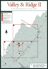
and Ridge II In this book, the Valley and Ridge province is divided into three sections: Valley and Ridge I, Valley and Ridge II, and Valley and Ridge III. Valley and Ridge II includes sites ranging from wilderness areas to historic inns to outstanding state parks. The western border of this section of the Valley and Ridge province begins in Craig County and follows the West Virginia/Virginia state line until it reaches US 250 and the northern border of the Deerfield Ranger District of the George Washington National Forest. The eastern border of Valley and Ridge II begins north of Roanoke and ends north of Staunton on Interstate 81 in Augusta County. This section has some of Virginia's more popular outdoor attractions, including Douthat State Park, the James River District, and Ramsey's Draft Wilderness. (For more information on the geology of the Valley and Ridge province, see the introduction to the Valley and Ridge section.)
Read and add comments about this page