 Marshall
Forest Nature Preserve
Marshall
Forest Nature Preserve 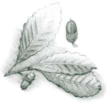
The Great Valley, situated between the Armuchee Ridges and the Cohutta Mountains, has long presented to all types of life an easy route from the coastal lowlands of Alabama to the north Georgia mountains and farther north into Tennessee and possibly North Carolina. This was true even in prehistoric times, when such animals as barking tree frogs and cottonmouth moccasins moved northward along the sluggish streams, swamps, and oxbow lakes of the Coosa River. These watery roads were probably main trading routes between Creek and Cherokee nations. The names of great rivers like Conasauga, Oostanaula, Coosawattee, and Etowah attest to their Indian heritage. Etowah Mounds, Georgia's best-known Indian village, is near the junction of the Etowah River and Pumpkinvine Creek. The wide bottomlands of the valley, their timber already killed in many areas by beaver, presented fertile settings for the corn-bean-squash agriculture of the Mississippian period of Indian culture (1000 a.d.–1500 a.d.). In this region Indians trapped great spawning runs of fish such as the small-mouth buffalo and the freshwater drum. Tons of these fish were captured, smoked, and dried. The unpolluted rivers were also full of large freshwater clams. Chestnuts, black walnuts, and acorns of the lush valley forest, together with abundant game, supplemented the Indian diet.
The first white settlers must have eyed the Great Valley as a land of Eden when they arrived. As settlement of the territory continued, the Coosa River system opened up a large market for the goods grown here.
[Fig. 11(6)] Located on the banks of the Oostanaula River, this was the nineteenth-century home of Major Ridge, a prominent Cherokee Indian who, along with his family, operated a ferry boat, owned a store, and lived as slaveowner planters. The museum in the white clapboard plantation house contains exhibits describing Ridge's life and the history of Rome and northwest Georgia. Visitors can walk on a paved trail along the river. There is also an archeological dig at the site.
Marshall
Forest Nature Preserve
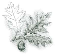
[Fig. 11(7)] Marshall Forest,
an old growth forest with remnants of virgin forest, was designated Georgia's
first National Natural Landmark in 1966. The 104-acre forest was donated to
The Nature Conservancy in 1976 by the Marshall family, who had owned and protected
it for nearly a century. About 300 plant species, including 46 tree species,
grow here. The trees are a mixture of northern and southern species. Northern
red oak and chestnut oak are near the southern limits of their ranges, while
longleaf pine is near its northern limit. The forest is home to several rare
and un-
usual species. Access to the area is by special permission or guided tour only.
Tours are provided by the Marshall Forest Stewardship Committee and may be arranged
by calling the office. Students from several colleges and universities in the
state have used the forest as a research site.
There are five trails, but most tours are conducted on the braille trail, which was designed for the visually impaired. Unfortunately, all of the trails are unkept. Lists of plants, birds, and trees are available.
[Fig. 11(9)] Mayo's Bar Lock and Dam were built on the Coosa River at Horseleg Shoals to facilitate the movement of steamboats and barges upstream from Alabama to Rome. As many as 50 steamboats operated on the Coosa River between Rome and Greensport, Alabama, during the mid- to late 1800s. These steamboats had difficulties navigating through shoals located throughout the river. At Horseleg Shoals, the worst of these shallow sandbanks, local citizens built temporary dams to create a deeper pool of water. Congress ordered a survey of the Coosa River in 1870, but it was not until 1913 that the lock and dam near Rome was completed. By the time of its completion, only three commercial boats remained on the river, and one of these was the Corps of Engineers' dredge. The steamboats turned to transporting passengers for picnics, parties, and hunting and fishing trips. River traffic dwindled until the lock was finally closed in 1941.
[Fig. 11(11)] Cave Spring, settled in 1829, is a picturesque village in beautiful Vann's Valley. Definitely off the beaten track (about 8 miles east of the Alabama border, 15 miles south of Rome), the small community has been able to preserve its charm and integrity from modern development. Over 90 structures in Cave Spring are listed on the National Register of Historic Places.
Cave Spring's original claim to fame is its namesake mineral spring, flowing from a cave in Rolater Park, which covers 29 acres of natural landscape inside the village. Little Cedar Creek flows through the park and village. The park has covered pavilions and picnic tables under beautiful trees. The large limestone cave is a popular attraction. It is open to the public during the summer and boasts a cool temperature of 56 degrees. The mineral spring has a capacity of about 4 million gallons a day of the "purest water in Georgia," which is now being bottled and sold in stores. There is a 1.5-acre swimming pool, the second largest in Georgia, which is fed by spring waters. The Hearn Academy Inn is also on park grounds. Begun in 1839 as a dormitory for the Hearn Manual Labor School, it has been restored by the Cave Spring Historical Society, which offers tours of the building during Country Festival Week. Bed and breakfast are available here, as well as catered parties and weddings by reservation.
Also in Cave Spring is the Georgia School for the Deaf. Its first five students were admitted in 1846. The school is still in its original location. During the second weekend in June, the Annual Country Festival and Road Race includes tours of Hearn Academy and an arts festival.
[Fig. 11(5)] Berry College was founded around the turn of the century by the remarkable Martha Berry. She lured industrialists such as Henry Ford and politicians such as Teddy Roosevelt here and convinced them to support her efforts to educate rural mountain children getting their first chance at formal schooling.
Berry is one of the largest campuses in the world (28,000 acres). In the early years studies were conducted in log cabins which still stand, well preserved, but now Berry students use 40 more-modern buildings. Most of the property owned by the college is farmland which is worked by students in accordance with the founder's idea that every student should work part time on campus to help defray tuition costs.
The campus is testimony to one woman's determination to bring education to children of the mountains. A tour of its grounds and buildings provides the visitor with insight into the isolated, hard, determined and proud nature of life in these hills during the first half of the century. The guard at the main entrance has maps for a self-guided tour. Highlights of this tour include the Gothic architecture of the Ford Quadrangle; the old mill wheel, one of the largest overshot waterwheels in the world; and picturesque agricultural buildings.
[Fig. 11(1)] The house built by the Cherokee chief James Vann in 1804 and called "Showplace of the Cherokee Nation" is preserved as the Vann House Historic Site. James Vann, son of a Scottish trader and a Cherokee woman, helped establish the Moravian mission at Spring Place in 1801. In sponsoring the mission school, he contributed to the education of the Cherokee young, including several of the nation's future leaders. He was reputed to be generous when sober and pugnacious when drinking—which he did often. He was shot at Buffington's Tavern on February 21, 1809, at age 41. He had expected to leave his vast holdings to his young son, Joseph, but the Council of Chiefs intervened to divide the property between his widow and all of his children.
Joseph Vann managed nevertheless to acquire the house and much of his father's other property. An even better businessman than his father, he became known as "Rich Joe Vann" by the Indians and whites alike. During the 1830s push for Indian removal in Georgia, Vann made the mistake of hiring a white man as overseer of his plantation. Thus he unwittingly violated a new Georgia law declaring it illegal for a white man to work for an Indian. Because of this, his house and land were claimed by the state. During a dispute over ownership between a white boarder in the house and the Georgia Guard, the stairway was set on fire. The charred flooring is still visible.
When turned out of their home in Georgia, the Joseph Vann family moved first to a farm he owned in Tennessee and then traveled by steamboat to Webbers Falls, Oklahoma, where he built a duplicate of the Georgia Vann House. That house was destroyed by Union forces during the Civil War. In the 1840s, after much litigation, the federal government later paid Joseph Vann $19,605 for his property in Georgia: a fine brick house, 800 acres of cultivated land, 42 cabins, 6 barns, 5 smokehouses, a grist mill, a sawmill, a blacksmith shop, 8 corn cribs, a shop and foundry, a trading post, a peach kiln, a still, 1,133 peach trees, 147 apple trees, and more.
Joseph Vann operated a steamboat line after he moved to Oklahoma. He met his death in October 1844 when an overheated boiler on his steamboat exploded during a race with another vessel on the Ohio River.
After deteriorating for 150 years, the house and three acres were purchased by the community and presented to the Georgia Historical Commission in 1952. The house was restored and dedicated in July 1958. Many priceless relics of the family were returned to the house as exhibits.
[Fig. 11(4)] By 1825 the Cherokee Nation had discarded the tribunal Council of Chiefs as a ruling body and patterned their government on the republican form of the United States. In November 1825 the legislature of the Cherokee Nation, which covered the area from eastern North Carolina westward through northern Georgia into northeastern Alabama and eastern Tennessee, established its capital at New Echota. Among the many buildings constructed there were a number of commercial buildings, a legislative hall, a supreme court building, and a mission station.
Prior to 1827, Sequoyah created the first written form of the Cherokee language. In response to his syllabary, the American Board of Commissions for Foreign Mission, which was based in Boston, underwrote most of the cost of establishing a print shop in New Echota. A member of the board, Samuel A. Worcester, settled in the community in 1827. Thirteen years after the establishment of New Echota, the U.S. Congress ordered the removal of the Cherokees to the West. This forced march in the winter of 1838–39 caused the death of 4,000 people and became known as the Trail of Tears. After this march, the town quickly fell into disrepair, and by the twentieth century the site was lost.
In the early 1950s, a group of Calhoun citizens purchased 200 acres of the original site and deeded it to the state of Georgia. Thirteen buildings have been restored or reconstructed, and guided tours are available.
[Fig. 11(8)] This museum, the largest mineral museum in the Southeast, was established in 1983 by the Cartersville Tourism Council with a donation from the family of William J. Weinman, a pioneer in barite mining in Bartow County. It is dedicated to the collection and exhibition of minerals, rocks, gemstones, and fossils from Georgia and around the world. It provides lapidary and identification services. Part of the facility is set aside for lapidary research and classroom activities. A new wing and a library were added in 1987.
The Georgian Exhibit Hall features a simulated limestone cave with a waterfall that dramatizes the dynamics of cave formation. The hall also houses a local mining display, local fossil finds, and other specimens from Georgia. Many of the exhibits throughout the museum may be touched.
Lectures by a museum consultant on a variety of topics including rock and mineral identification, birthstones, fossils and fossilization, and the solar system may be scheduled by appointment. On the second Saturday in June, the museum hosts its annual rock swap.
[Fig. 11(12)] The Etowah Mounds and Village of the Mississippian Indians were occupied between 1000 a.d. and 1500 a.d. Several thousand Indians may have lived in this fortified town at the peak of its prosperity. It was the center of political and religious life in the valley and home to the chiefs who directed the growth, storage, and distribution of food.
Three flat-topped ceremonial mounds that served as platforms for temples or residences for chiefs and priests are located on the floodplain at the juncture of the Etowah River and Pumpkinvine Creek. The village was surrounded by a stockade and deep ditch on all but the river side. It was linked to other Mississippian towns by the Etowah River. Visitors may take a self-guided tour of the mounds. The entire walk is a little over .5 mile.
An excellent museum explains the archeological interpretations of the lives of people of the community. Many artifacts, including ceremonial objects, pottery tools, and many shell beads, are on display. This is the only archeological site in northwest Georgia open to the public. Special events at this site include an Indian skills day in the spring, artifacts identification days (April and November), and astronomy programs.
Read and add comments about this page