 The
Cumberland Plateau and the Valley and Ridge
 The
Cumberland Plateau and the Valley and Ridge
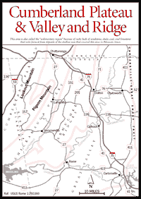
Northwest Georgia is here divided into four parts—the Cumberland Plateau, the Chickamauga Valley, the Armuchee Ridges, and the Great Valley. The Chickamauga Valley, Armuchee Ridges, and Great Valley are collectively known as the Valley and Ridge. Physiographers consider the Cumberland Plateau to be part of a larger area to the west, the Appalachian Plateau province, which extends from Alabama northeastward through Tennessee and Kentucky. Northwest Georgia is distinctly divided from the remainder of the Georgia mountains to the east by a great break in the earth's surface called the Cartersville–Great Smoky Fault. Strange-looking rocks, arranged in layers and often embellished with fossil sea life, tell the visitor that he is in a quite different world from the more familiar Blue Ridge Mountains. Here in the northwest one finds long, linear ridges alternating with equally long valleys and straight streams—unlike the irregular mix of peaks and valleys in the Blue Ridge, where the drainage is dendritic like the branches of a tree.
This area is also called the "sedimentary region" because its rocky beds of sandstone, shale, coal, and limestone are clearly recognizable as having once been, respectively, sand, mud, plants, and marine life deposited in shallow seas that covered this area in Paleozoic times. The mountains may be flat-topped especially in the Cumberland Plateau, where the more nearly horizontal beds occur in "layer-cake" fashion, the younger ones lying on top.
This was an era of ancient life—largely marine invertebrates and primitive fishes. Between 300 and 425 million years ago (Mississippian and Silurian periods), these animals were entombed as fossils in various types of ocean floor materials—some in the limy shells of tiny organisms which formed limestone, and others in mud which became shale. These older animal fossils are most easily found in the Armuchee Ridges. During the Carboniferous or "coal measures" some 300 million years ago, the top of the Cumberland Plateau was the scene of swamps and fertile deltas. These deposits now yield plant fossils as well as coal deposits. Fossils are found in northwest Georgia because heat and pressure were not great enough to destroy them, as happened in the Blue Ridge.
The long, southwest-northeast-trending, limestone-floored valleys have been natural corridors for the passage of Coastal Plain life into the interior of Appalachia. Man, too, has used these fertile corridors in agriculture and in war. Because these plateaus, ridges, and natural passageways are coupled with extensive beds of mineral-rich carbonate rocks, one finds many plants and animals here which occur nowhere else in the Georgia mountains. The caves, springs, sinkholes, and animals (such as the cottonmouth water moccasin) of the Cumberland Plateau and Valley and Ridge are not what one would expect to find in the northern part of our state; hence, this area seems more closely allied with southwest Georgia than with the Blue Ridge. Also, a number of plants and animals that seem rare to us range into Georgia only here, representing species more commonly found to the west in areas such as the Cumberland Mountains of Tennessee and Kentucky.
Rugged and isolated, this is a region with its own geography, color, and personality. The landscape is dominated not only by the 84-mile-long Lookout Mountain, but also by the dramatic interplay of clouds and sunlight across the mountain and its valleys. Little wonder former residents chose place names like Cloudland, Craigsmere, Rocktown, and Lookout. This is a land relatively unknown until recently to tourists, casual visitors, or even outdoor recreational enthusiasts, who have long been attracted to the mountains in the eastern part of the state. It has remained the province of local inhabitants; summer residents around Mentone, Alabama; adventurous cavers; and hang gliders seeking the best takeoff point on the East Coast. Those who discover this region are soon under its spell and find themselves returning again and again.
Read and add comments about this page