The Shenandoah Mountains
Two ranger districts of the George Washington National Forest [Fig.
25]—Deerfield Ranger District and Dry River Ranger District—lie
end-to-end in the Shenandoah Mountains west of Staunton and Harrisonburg.
Long Shenandoah Mountain which dominates the scene has its beginnings in northeastern
Bath County at Green Valley. The ridge runs northeastward along the western
borders first of Augusta County then of Rockingham County. The two ranger districts
take in Shenandoah Mountain and most of the mountainous area to the east, ending
at the western edge of the Shenandoah Valley.
Deerfield Ranger District
The Deerfield Ranger District of the George Washington National Forest spreads
across 164,183 acres of western Augusta County, eastern Highland County, and
northeastern Bath County. The Cowpasture River defines the western boundary.
Scenic highways (US 39 on the south and US 42 on the east) roughly define two
sides. US 250, which connects the city of Staunton in Augusta County to the
town of Monterey in Highland County, runs along the border for about 3 miles
on the northeastern edge. Then the boundary veers northwest of US 250 taking
in the headwaters of the Calfpasture and Cowpasture rivers. The line goes across
the top of Hankey Mountain and around the north side of Ramseys Draft Wilderness
connecting with the southern corner of Pendleton County, West Virginia.
The national forest lies mostly in three large tracts around a Y-shaped valley
of private land. Great North Mountain and Crawford Mountain lie end-to-end to
make up one tract on the eastern side. The southern end of long Shenandoah Mountain
forms a second tract on the district's western side. At the top of the Y is
Walker Mountain, the third tract, which rises from the valley floor southwest
of the village of Deerfield, separating Deerfield Valley along VA 629 from pretty
Marble Valley along VA 600.
VA 629 runs the entire length of pastoral Deerfield Valley, passing by farms
outlined by long white fences, past churches, swinging bridges, country stores,
old log cabins, forested hollows, rocky creeks, and mountain backdrops—a
road as appealing and full of charm as many with official scenic status. The
placid Calfpasture River flows first through Deerfield Valley, between West
Augusta and Deerfield, then veers south into equally bucolic and lovely Marble
Valley along VA 600. Where it passes close to the highway, the river adds beauty
to the landscape but its waters are considered nonnavigable, which puts it off
limits for recreation.
Mountain slopes in the Deerfield District are forested with typical eastern
deciduous hardwoods interspersed with pines. Hardwoods include such trees as
chestnut oak, northern red oak, white oak, shagbark and pignut hickories, red
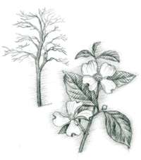
maple, tulip poplar, and American beech. A sequence of blooms comes in spring
from understory trees and shrubs: first from shadbush then Eastern redbud, flowering
dogwood, mountain laurel, deerberry, and blueberry. Hemlocks, sycamores, and
thickets of mountain laurel and rhododendron line the ravines.
The creamy white blossoms of bloodroot (Sanguinaria canadensis) sprout
almost magically from the leaf litter of forested slopes in spring. Occasional
sprinklings of large-flowered trillium (Trillium grandiflorum), painted
trillium (Trillium undulatum), or the foul-smelling purple trillium (Trillium
erectum) add their colors of white, pink, and magenta. In late summer, roadsides
are dotted with blue from chicory (Chichorium intybus), yellow from black-eyed
susan (Rudbeckia hirta), white from Queen Anne's lace (Daucus carota),
and even occasional patches of red rasp- berries warmed by the sun.
Two recreation areas—Mountain House and Braley Pond—offer fishing,
hiking, and picnicking. Although there are no developed campgrounds, the district
is highly prized by seekers of solitude for its 124 miles of hiking trails.
Backpackers, mountain bikers, anglers, hunters, and horseback riders take advantage
of national forest policy of allowing backcountry camping anywhere. A third
recreation area—Confederate Breastworks—attracts those interested
in Civil War history.
- Directions: District office is located on VA 254, 1 mile west of
Staunton.
- Activities: Hiking, fishing, picnicking, seasonal hunting, horseback
riding, mountain biking, backcountry camping.
- Facilities: Picnic area, historic area, 124 miles of trails, rifle
range.
- Closest town: Staunton, 9 miles west from eastern edge of district.
- For more information: Deerfield Ranger District, George Washington
National Forest, Route 6, Box 419, Staunton, VA 24401. Phone (540) 885-8028.
Augusta Springs Watchable Wildlife Area. [Fig.
26(18)] This 50-acre tract on the eastern end of Great North Mountain is
a department superstore to wildlife. It has marshes, open grassy fields, and
an oak-hickory upland forest.
The open fields attract such species as meadowlark, bluebird, goldfinch, bobwhite
quail, red fox, rabbit, vole, and mice. White-tailed deer, gray fox, bobcat,
and woodcock are just a few examples of animals that benefit from a combination
of woods and fields.
 Marshes
are typically rich with life. There are varieties of dragonflies, damselflies,
crane flies, salamanders, turtles, snails, and nematodes. Canada geese feed
in both the marsh and the field. The yellow-striped heads of baby wood ducks
peek from the holes of large nest boxes. The marsh can be a noisy place in spring
and summer with spring peeper frogs, cricket frogs, and pickerel frogs clamoring
for attention from the opposite sex.
Marshes
are typically rich with life. There are varieties of dragonflies, damselflies,
crane flies, salamanders, turtles, snails, and nematodes. Canada geese feed
in both the marsh and the field. The yellow-striped heads of baby wood ducks
peek from the holes of large nest boxes. The marsh can be a noisy place in spring
and summer with spring peeper frogs, cricket frogs, and pickerel frogs clamoring
for attention from the opposite sex.
The Augusta Springs area is attractive to humans as well. A half mile of boardwalks
make it easier to get close to wetland critters that usually must be viewed
from long distances. Among the watched wildlife are beaver, muskrat, water snakes,
red-winged blackbirds, great blue herons, green herons, great egrets, and spring
and fall migrating waterfowl. The area is managed as part of the National Watchable
Wildlife Program. Federal and state agencies, conservation organizations, and
private businesses cooperate to enhance wildlife habitat and build public viewing
stations.
- Directions: From Staunton, go west on VA 254 for 9 miles. Continue
straight on VA 42 at Buffalo Gap and drive 8.5 miles. Look for the brown sign
with binoculars symbol that marks Watchable Wildlife Areas.
- Activities: Wildlife and birdwatching, wildflower identification,
photography, nature study.
- Facilities: Handicapped-accessible interpretive nature trail, boardwalks,
rest-rooms. Wildlife viewing blinds in planning stage.
- Dates: Open year-round.
- Fees: None.
- For more information: Deerfield Ranger District, George Washington
National Forest, Route 6, Box 419, Staunton, VA 24401. Phone (540) 885-8028.
- Closest town: Craigsville, 4 miles southwest.
Braley Pond Recreation Area. [Fig.
26(16)] Situated at the north end of scenic Deerfield Valley, Braley Pond
Recreation Area is an ideal spot for picnicking, fishing, and hiking. The 4.5-acre
pond was constructed by the U.S. Forest Service for flood control. Artificial
reefs and other fish structures have been added. Keeper-sized rainbow trout
are stocked, and largemouth bass, bluegill, and channel catfish have been introduced.
Bank fishing is possible all the way around, and hand-carried boats without
motors are allowed.
The picnic area is set in a stand of white pines. Surrounding the recreation
area are remote, undeveloped mountain lands offering good hiking, hunting, camping,
and photo opportunities. Primitive camping is also allowed among the trees of
the recreation area.
- Directions: From the junction of VA 275 and US 250 west of Staunton,
drive about 15 miles west on US 250. Turn right on VA 715 and take the next
left onto FR 348.1. Follow signs about .5 mile to parking lot.
- Activities: Fishing, picnicking, hiking, mountain biking, horseback
riding, seasonal hunting in surrounding national forest.
- Facilities: 5-acre fishing pond, 10 picnic tables and grills, toilets.
- Dates: Open year-round.
- Fees: None.
- Closest town: Staunton, 16 miles east.
- For more information: Deerfield Ranger District, George Washington
National Forest, Route 6, Box 419, Staunton, VA 24401. Phone (540) 885-8028.
Mountain House Picnic Area and Confederate Breastworks. [Fig.
26(12,13)] Mountain House is a day-use picnic area near the site of a former
wayside on the old Parkersburg Pike (now US 250) across a series of mountain
ranges to Parkersburg, West Virginia. A tollhouse constructed here before the
Civil War became a popular rest stop in the late 1800s. Ramseys Draft Wilderness
Area trailhead is located on the access road behind the picnic area.
The Confederate Breastworks are on Shenandoah Mountain about 2 miles west of
Mountain House Recreation Area. Here, Confederate soldiers constructed a long
trenchlike fortification in 1861 or early 1862 to protect the valley from invasion
by Union forces from the west. Troops that built the fortifications were probably
members of the 12th Georgia Infantry Regiment serving under General Edward "Allegany"
Johnson. After a breach in the fortifications, General Johnson pulled back.
With the arrival of General Stonewall Jackson, Union troops were rebuffed at
the Battle of McDowell (May 8, 1962) and driven back into the Jackson River
Valley toward West Virginia.
A short loop trail follows the remnants of the breastworks, and the trailhead
for the northern 7.1-mile section of the Shenandoah Mountain Trail is here.
The panoramic view of the Cowpasture River Valley to the west is, by itself,
worth the stop.
- Directions: From junction of VA 275 and US 250 west of Staunton,
drive about 20 miles west on US 250 to Mountain House Recreation Area, at
junction with FR 68, on right. Mountain House is about 5 miles past turnoff
to Braley Pond. The parking area for Confederate Breastworks is about 2 miles
farther on right side of US 250 at top of Shenandoah Mountain.
- Activities: Picnicking, hiking, fishing in Ramsey's Draft (check
Virginia Department of Game and Inland Fisheries for latest regulations).
- Facilities: Mountain House has 10 picnic tables with grills, toilets,
and trailhead for Ramseys Draft. No drinking water. Confederate Breastworks
historic site has loop trail and toilets.
- Dates: Open year-round.
- Fees: None.
- Closest town: Staunton, approximately 22 miles east.
- For more information: Deerfield Ranger District, George Washington
National Forest, Route 6, Box 419, Staunton, VA 24401. Phone (540) 885-8028.
Hiking the Deerfield District. An extensive trail system totaling 124
miles makes hiking a highlight of the district. Some trails are long, running
along mountain ridges, giving backpackers a challenge and rewarding them with
outstanding views. The terrain is rough and mountainous, but, for the most part,
trails are wide, well signed, and well groomed. The notable exceptions are the
Ramseys Draft Wilderness trails, purposely left in a more natural state.
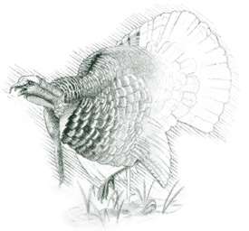
 Wanderers
on district trails see or find signs of white-tailed deer, black bear, wild
turkey, ruffed grouse, bobcats, mink, and gray squirrel. Bird watchers on a
spring morning are treated to the songs of migrating warblers and indigo buntings.
On summer nights, bone-tired hikers slip into their sleeping bags on Shenandoah
Mountain to be lulled to sleep by the hoot of a great horned owl or haunting
call of a whip-poor-will.
Wanderers
on district trails see or find signs of white-tailed deer, black bear, wild
turkey, ruffed grouse, bobcats, mink, and gray squirrel. Bird watchers on a
spring morning are treated to the songs of migrating warblers and indigo buntings.
On summer nights, bone-tired hikers slip into their sleeping bags on Shenandoah
Mountain to be lulled to sleep by the hoot of a great horned owl or haunting
call of a whip-poor-will.
In fall, hikers along ridgetop trails walk a carpet of fallen red, yellow,
and gold leaves beneath red maples, tulip poplars, and white and red oaks. Above
them, hawks and other birds of prey ride the updrafts along the ridges heading
south ahead of winter. A light January snowfall requires a traveler to engage
his four-wheel drive to cross Great North Mountain on US 250 on his way to frozen
Braley Pond where his footprints will be the only sign of a human.
Shenandoah Mountain Trail. [Fig.
26(14)] This 30.7-mile path, blazed with yellow diamonds, follows the ups
and downs along the crest of Shenandoah Mountain for the entire length of the
district. It features excellent views of Deerfield Valley to the east and Cowpasture
River Valley to the west. In the fall, the foliage of red maples, birches, locusts,
chestnut oaks, scarlet oaks, and tulip poplars is brilliant against evergreen
hemlocks, pines, rhododendron, and mountain laurel.
The long, linear Shenandoah Mountain Trail connects with several old roads
and other trails to provide shorter loop hikes. Skillful grading of the trail
on the mountain's rough terrain can be credited to the men of the Civilian Conservation
Corps (CCC) who built it in the 1930s. Because of the trail's gradual changes
in altitude, cross-country skiers and mountain bikers also use it. However,
where the 7.1-mile section north of US 250 meanders into and out of Ramseys
Draft Wilderness, biking and skiing may be difficult. In keeping with the intent
of the wilderness, trail maintenance is limited to what is necessary for safe
passage. Parts of the Shenandoah Mountain Trail are designated as especially
suitable to horse travel. The district office can provide a brochure.
- Directions: From junction of VA 275 and US 250 west of Staunton,
drive about 22 miles west on US 250 to Confederate Breastworks parking area
on top of Shenandoah Mountain. From here a 7.1-mile section leads north and
a 23.6-mile section leads south.
- Trail: 30.7-mile linear path along crest of Shenandoah Mountain.
- Elevation: 3,000—3,600 feet.
- Degree of difficulty: Moderate, with strenuous sections.
- Surface and blaze: Natural forest floor with rocky sections. Blazed
with yellow diamonds.
North Mountain Trail. [Fig.
26(20)] Solitude and spectacular views are the rewards for taking this 14.5-mile
path along the ridge of Great North Mountain. Though steep in places, the trail
is suitable for day hiking, backpacking, and horseback riding. It passes just
below the 4,458-foot peak of Elliott Knob, one of the highest points of the
George Washington National Forest and the site of an old fire tower. (Another
unrelated North Mountain Trail is in the New Castle Ranger District.) Where
the North Mountain Trail terminatess on the northern end, the 8-mile Crawford
Mountain Trail begins.
The altitude at Elliott Knob is sufficient for trees more typical of northern
forests such as red spruce, yellow birch, and sugar maple. However, many other
complex factors such as soil composition, weather, slope orientation, and distance
from other pockets of high-altitude trees also influence which trees take hold
in a particular area. With the exception of a few scattered examples of northern
species near the summit, Elliott Knob is not a holdout for alpine flora and
fauna in the way that the Laurel Fork area is in northwest Highland County,
farther west.
Near Elliott Knob, the 2.2-mile Cold Springs Trail [Fig.
26(19)] descends steeply down the western slope of North Mountain Trail
to the Cold Springs Road (FR 77). This was the route to the fire tower which
was in use in the 1950s. Rock ledges provide views of Deerfield Valley.
- Directions: For northern trailhead, take VA 254 from Staunton west
to Buffalo Gap. Go south on VA 42 for .7 mile. Turn right by a white church
onto VA 688, and go about 2 miles to trailhead on top of North Mountain. For
southern trailhead, from Craigsville, in southwestern Augusta County, go south
on VA 42 for 2 miles. Turn right on VA 687 and go 3 miles to top of mountain.
For Cold Springs trailhead, from US 250 at West Augusta, go south on VA 629
for 3 miles. Turn left on VA 688 and drive about 2 miles. Go right on FR 77
and drive 3.3 miles to trailhead parking.
- Trail: 14.5-mile linear path along ridge of North Mountain.
- Elevation: 1,600 to 4,458 feet.
- Degree of difficulty: Moderate, with strenuous sections.
- Surface: Natural forest floor with rocky sections.
Ramseys Draft Wilderness Area
[Fig.
26(15)] The 6,519 rugged, steep acres of Ramseys Draft Wilderness lie on
the southeastern slope of Shenandoah Mountain and on the north side of US 250
about 20 miles northwest of Staunton. The word "draft" is an old mountain
word for "creek." Ramseys Draft, in the headwaters of the Calfpasture
River, flows through the middle of the wilderness. The creek begins in the northeastern
end of the wilderness as a right and left fork on either side of Hardscrabble
Knob which, at 4,280 feet, is the area's highest point. The branches merge and
flow southwestward through the wilderness to exit at the southern end.
About 29 miles of trails allow access around and into this wilderness. However,
heavy rains from hurricanes Camille in 1969 and Agnes in 1972 and major flooding
in 1985 changed the course of streams and caused severe washouts on some trails,
most notably on Ramsey's Draft Trail, which is the main artery through the wilderness.
An impressive mature forest—a magnet to nature lovers—lies at the
heart of this wilderness. According to the U.S. Forest Service, the virgin stream-bottom
stand of cove hardwoods, white pine, and hemlock is more than 300 years old—one
of only a handful of virgin tracts of its size in the East. Most trees in this
tract, located between the right and left forks of Ramseys Draft, are original
growth.
The journey is not easy across rough wilderness terrain to reach the big evergreens
and hardwoods, but getting there is half the fun. Those who make the trek are
invariably stunned when they arrive to stand beneath forest giants that were
already a century old when the country declared its independence. There's a
desire just to touch the massive trunk of a hemlock that is more than 300 years
old. Hikers stand in amazement as they look up at the towering canopy of white
oaks and tulip poplars which may climb to heights of 120 feet or more.
The exhilarating scene is tempered by sadness, though. The giant hemlocks are
obviously diseased, slowly succumbing to the persistent attack of the forest
pest called the wooly adelgid (see
Ghost Forests).
With no remedy in sight, the aged evergreens will one day be gone, allowing
sunlight through the canopy to begin anew the succession of understory plants
that culminates in old-growth forest.
 Ramseys
Draft Trail. [Fig.
26(15)] This 7-mile trail (14-mile round trip) leads up Ramseys Draft through
a mature forest managed essentially as wilderness since 1935. To the northwest
is the ridgeline of Shenandoah Mountain, and to the southeast is Bald Ridge.
At about 4 miles into the wilderness, the creek splits into a left and right
fork at the base of Hardscrabble Knob. The large stand of virgin forest begins
here and follows the left fork away from the trail. The trail accompanies the
right fork around the east side of Hardscrabble Knob, and then it climbs to
the 4,282-foot summit from the back side. Circuit hikes are possible with trail
connections at the northern end of the wilderness.
Ramseys
Draft Trail. [Fig.
26(15)] This 7-mile trail (14-mile round trip) leads up Ramseys Draft through
a mature forest managed essentially as wilderness since 1935. To the northwest
is the ridgeline of Shenandoah Mountain, and to the southeast is Bald Ridge.
At about 4 miles into the wilderness, the creek splits into a left and right
fork at the base of Hardscrabble Knob. The large stand of virgin forest begins
here and follows the left fork away from the trail. The trail accompanies the
right fork around the east side of Hardscrabble Knob, and then it climbs to
the 4,282-foot summit from the back side. Circuit hikes are possible with trail
connections at the northern end of the wilderness.
A major flood in 1985 changed the course of Ramseys Draft in places and washed
out much of an old road that once served as the Ramseys Draft Trail. Even before
that time, hikers had to make 13 stream crossings. With its wilderness designation,
the Draft is being left in its disheveled state. The trail is sometimes hard
to follow even with orange blazes.
Just hiking the 4 miles up the draft to the old-growth forest—an 8-mile
round trip—can easily take a day's time. Despite the arduous hike, Ramsey's
Draft Trail is so heavily used that rangers are concerned it may lose its wilderness
character. Hikers should tread lightly, stay on paths, and be careful not to
harm vegetation. Other wilderness areas may offer more solitude. Because of
numerous stream crossings, the hike should not be attempted in periods of high
water. The debris-strewn path slows hiking and can sap the strength of the unfit.
 Six
other trails provide access to Ramseys Draft. These include Shenandoah Mountain
Trail (north and south ends), Bald Ridge Trail, Sinclair Hollow Trail, and Wild
Oak Trail (two sections). A map of the wilderness and its trails is available
from the district office in Staunton.
Six
other trails provide access to Ramseys Draft. These include Shenandoah Mountain
Trail (north and south ends), Bald Ridge Trail, Sinclair Hollow Trail, and Wild
Oak Trail (two sections). A map of the wilderness and its trails is available
from the district office in Staunton.
- Directions: From the junction of VA 275 and US 250 west of Staunton,
drive about 20 miles west on US 250 to Mountain House Picnic Area on right.
Turn right into Mountain House picnic area and go .1 mile to trailhead parking.
- Trail: 7-mile (one-way) rough trail with numerous stream crossings
up Ramseys Draft, then along right fork of creek to summit of Hardscrabble
Knob. Old-growth forest begins after 4 miles where Ramseys Draft splits into
left and right fork. The largest trees are along left fork.
- Elevation: 2,200—4,482 feet.
- Degree of difficulty: Moderate, with difficult sections and a strenuous
climb at the far end beyond old-growth forest.
- Surface: Natural forest floor, old roadbed, downed trees, stream
crossings.
Read
and add comments about this page
Reader-Contributed Links to the Virginia Mountains Book: