 The
Natural History of the Georgia Coast
  The
Natural History of the Georgia Coast
 As you sit in your beach chair and waves lap your bare feet with reassuring regularity, you, the lover of sea, salt, and sun, feel connected to the infinite. To the poetic soul, the Georgia coast seems like eternity itself, with the natural rhythms of tides and seasons keeping tempo in the ceaseless flow of time. The miles and miles of pungent, sun-baked salt marsh, the intense heat and light of the sand dunes, and the flickering green canopy of the live oak forest make an indelible impression upon the senses. Surely this is the way it has always been and will always be.
Geologists are not so impressed. They know that the coast is quite young and always changing. Sixty million years ago, all this property was under water and the coastline was much farther inland. During the height of the last Ice Age approximately 18,000 years ago, sea level was 400 feet lower and the coastline was 95 miles east of its current position. And as average sea level continues to rise, the current coastline may once again be submerged.
In fact, Georgia's bluffs, marshes, and barrier islands are just the beautiful results of a lucky convergence of natural forces.
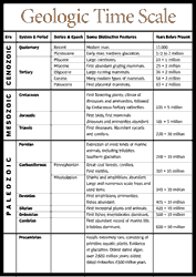
Georgia's coast is in the physiographic region known as the Lower Coastal Plain, and is made up of sediments washed down over millions of years from the Blue Ridge and Piedmont physiographic regions. During the end of the Cretaceous Era 65 to 70 million years ago, when dinosaurs last roamed the earth, the world experienced its greatest period of inundation, and the coastline was located at the present-day Fall Line that stretches from the towns of Columbus through Macon to Augusta. Sediments such as clays and sands washed down from the highlands and were deposited at this shoreline. At the dawn of the mammalian age, or Cenozoic Era 63 million years ago, the seas started to slowly drop. As you drive from Macon to Savannah, you pass by younger and younger soils of the Coastal Plain that were deposited as the sea receded. Mining operations in the Coastal Plain frequently uncover fossilized bones of prehistoric whales, sharks, and other marine creatures, more evidence of the Coastal Plain's past as an ocean floor.
 The
Lower Coastal Plain physiographic region begins at the shoreline and runs
inland for 60 miles. Its soils are Plio-Pleistocene and only 3 million years
old. During the Pleistocene Epoch that began 2 million years ago, the repeated
freezing and thawing of the polar ice caps raised and lowered sea levels,
which formed successive shorelines and barrier islands that today appear
as a series of inland sand ridges.
Barrier islands, common on the Atlantic and Gulf coasts, are globally rare. Barrier island chains front only 2.2 percent of the world's coastlines. Most of them are found where the Coastal Plain slopes gently, where there is abundant sand, and where waves supply enough energy to transport the sand.
Georgia's salt marshes are also a fortuitous result of having the right natural conditions: barrier islands to the east and rivers to the west. When sea levels rose, shoreline dunes became barrier islands, and the protected areas between the islands and the mainland became lagoons, which filled with trapped river sediments. As salinity was reduced from freshwater rivers, the right conditions were created for the formation of salt marshes.
Geologists have identified six strands of inland sand ridges of varying ages, each a little higher as one travels west from the coast. Because of their elevation and north to south orientation, these ridges have served as game trails, Indian trails, and highways. They also were popular sites for Indian, Spanish, and English settlements. The towns of Savannah, Darien, Brunswick, and St. Marys are located on the ancient barrier islands of the Princess Anne and Pamlico series that were formed when sea level was 15 to 25 feet higher. Trail Ridge is an ancient barrier island of the Wicomico shoreline that runs from Starke, Florida to near Jesup, Georgia, and disrupts drainage in this portion of the state and plays a crucial role in the formation of the Okefenokee Swamp.
During the Wisconsin Ice Age of 20,000 years ago, the shoreline was at least 50 miles to the east of its current position. As the earth warmed and the ice melted, sea levels rose and wrapped around sand dunes or ridges, which became barrier islands. As the sea level kept rising, some islands eroded and rolled backward over themselves. Approximately 4,500 years ago, sea level rise paused, leaving Georgia's barrier islands in their current positions. Some of the younger, Holocene islands have rolled all the way back to join an older, earlier series of sand ridges that were created in the Pleistocene Epoch 25,000 to 35,000 years ago. Some barrier islands, such as St. Catherines, Sapelo, St. Simons, and Cumberland, are composed mainly of Pleistocene soils in their cores on their western sides and Holocene soils on their eastern sides. Tybee and Wassaw islands are composed of young, Holocene soils and have not rolled back to meet their older, western Pleistocene neighbors of Wilmington and Skidaway islands. Scientists believe this is because Tybee and Wassaw islands are close to major river mouths and have been suppled with large inputs of sediment. Little St. Simons has grown tremendously over the last 100 years from Altamaha River sediments.
Salt marshes have been located both west and east of their current location on the Georgia coast. Behind the inland sand ridges or ancient barrier islands were salt marshes and tidal creeks, which today are timberlands and river swamps. Clay deposits exposed by eroding dunes fronting island beaches are evidence that marshes once were found in front of Georgia's coastal islands.
In the past century, global sea level has been rising at a rate of 6 inches a century. Because of global warming, United Nations scientists believe the rate will increase to 18 inches in the next century, which would push back the shoreline nearly 2 miles in places where the Coastal Plain slopes very gently.
Read and add comments about this page