 Bark
Camp Recreation Area
Bark
Camp Recreation Area [Fig. 12] South of Norton, on either side of the Wise and Scott county lines, Stone Mountain surges to a height of almost 4,200 feet at High Knob—the highest point of Virginia's Appalachian Plateau—before plunging toward the Clinch River to disappear in the earth at the edge of the Valley and Ridge province. Most of the mountain belongs to the Clinch Ranger District of the Jefferson National Forest. Three recreation areas, several disparate hiking trails, and wide-ranging natural environments give outdoor lovers plenty to do. Offerings include stunning views at High Knob [Fig. 12(5)], lakes to fish, shady mountain campgrounds, a new rails-to-trails hike through dramatic Guest River Gorge, a beaver-controlled wetland to explore, and another long trail that links many of the sites. Mountain bikers can patch together trails on the forest service roads and old logging roads that crisscross the mountain.
A little-known backroad, VA 653, stretches some 18 miles along the southern border of Stone Mountain between Sunbright and Dungannon. Spring wildflowers put on a show here, where the roadside and fields are spread with trillium, Dutchman's breeches, bleeding heart (Dicentra spectabilis), wild geranium (Geraniaceae maculatum), and trout lily (Erythronium americanum). To get to the North End of Stone Mountain from Dungannon, in northeastern Scott County, go north on VA 72 less than 1 mile and turn left on VA 653.
[Fig. 12(5)] At 4,162 feet (close to .8 mile high), the peak called High Knob is one of the highest points in mountainous southwest Virginia—or anywhere else in the state, for that matter. From the third story of the stone-and-timber, octagonal observation tower atop High Knob, a visitor can look into five states on a clear day. High Knob is a profoundly beautiful place, surrounded by mountains growing progressively smaller in the distance in Virginia, Kentucky, Tennessee, West Virginia, and North Carolina. Though off the beaten path, High Knob is readily accessible by VA 619 from Norton.
The road to the top, though, is a true anachronism—as tight and tortuous as any in Virginia today. Leave your motor home at the bottom. This road, with its frequent twists, switchbacks, and steep grades, is more suited to horse and wagon or perhaps stubby Model A coupes. The surface is narrow blacktop. The scenic road threads its way through dense hemlock and southern hardwood forests, as well as rhododendron thickets that bloom into early July at this high elevation.
Modern cars will experience no problems navigating the steep, 5-mile trip to the High Knob parking lot, but drivers may want to consider coming off the mountain in low gear to keep brakes from overheating. In winter, when ice and snow cover the old highway, it is best to forget the imposing mountain altogether. On a clear day, even a short trip to High Knob will reward visitors with panoramic views. Visitors who have more time will discover developed campgrounds; stocked, pristine streams and lakes for fishing or wading; a national forest with deer and turkey to hunt or photograph; a 4-acre lake for swimming; and a choice of hiking trails from 1.5 miles to 22 miles long. The High Knob observation tower is also a prime viewing area for the annual hawk migration in September and October.
Depression-era craftsmen employed by the Civilian Conservation Corps (CCC) built High Knob Recreation Area. Tight log buildings still stand, as does stonework of a beauty and mastery seldom seen today. Sturdy footbridges cross cascading mountain streams. The entire project, though more than half a century old, wears that gracefully aged and weathered look so typical of CCC undertakings in the Appalachian Mountains.
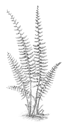
[Fig. 12(6)] The Chief Benge Scout Trail is a fairly difficult and mountainous 19.6 miles, but it offers more than ample rewards. It takes off from the High Knob observation tower through lush, waist-high carpets of jewelweed. The Scout Trail winds across knobs and through hollows, beside rushing streams and along canopied paths of Catawba rhododendron and mountain laurel. The lower end connects with Little Stony National Recreation Trail [Fig. 12(2)], and continues 3 miles to Hanging Rock at Dungannon. The trail provides an excellent opportunity for a two- or three-day backpacking trip. Anglers should pack a rod if they would like to catch stocked trout from Mountain Fork or Little Stony Creek. Or hikers can approach the trail in sections by leaving a second car at one of several access roads.
Chief Benge was a fierce Indian leader who terrorized southwest Virginia's early white settlers. He took savage umbrage at those who wanted to shove his people from their ancestral mountains west into flat, hot Oklahoma territory.
[Fig. 12(2)] This 2.8-mile path through the deep gorge follows Little Stony Creek through a 400-foot-deep and 1,700-foot-wide gorge, before Little Stony flows into the Clinch River northeast of Dungannon. It also connects the long Chief Benge Scout Trail [Fig. 12(6)] with Hanging Rock Picnic Area, at the southeast corner of Stone Mountain. Little Stony follows a narrow gauge railroad bed constructed in the early 1900s for logging. Most of it is wide, with a grade of only 4 to 5 percent, but hikers should be prepared to climb large rocks and boulders in places. Mountain laurel and rhododendron decorate the trail with white, pink, and purple in May and June. Cove hardwoods and hemlock have repaired the devastation done to the gorge itself by the logging operation in the 1920s. Rocky outcroppings and ledges tower high above the sheer sides of the gorge, while two waterfalls and numerous cascades tumble over boulders below.
Near the lower trailhead is Hanging Rock, the rocky upthrust caused by the Hunter Valley Fault. This fault line marks the northeastern border of the Appalachian Plateau's hold on Virginia.
Bark
Camp Recreation Area [Fig. 12(7)] Located in northern Scott County at 2,700 feet, Bark Camp makes a pleasant stopover for hikers on Chief Benge Scout Trail [Fig. 12(6)], between High Knob [Fig. 12(5)] and the junction with Little Stony National Recreation Trail [Fig. 12(2)]. They can camp in large wooded sites, fish for bass, trout, sunfish, and northern pike in the 60-acre, warm-water lake, or paddle the quiet waters with a canoe or kayak. Hikers can walk the lake perimeter on an easy 3.7-mile loop, a stroll beneath hemlocks where slanting rays of sunlight catch the yellow-green leaves of ferns covering the forest floor. The lake trail connects with Chief Benge Scout Trail.
[Fig. 12(12)] Here's a well-kept secret not found in the national forest handouts. Deep in the Clinch Ranger District, between High Knob and Bark Camp Lake, is a boggy meadow called The Glades. Here, nature's architect, the beaver, has taken advantage of typical Plateau topography on Stone Mountain to create his favorite habitat—a wetland. At an elevation of about 3,000 feet, beavers have felled trees to slow Glady Fork to a meandering, marshy series of pools and bogs before it tumbles down to Stony Creek. Consequently, seeds that cannot take hold under the hardwood canopies that cover most of Stone Mountain take a liking to the sunny, wet meadows. The pink, steeple-shaped flower clusters of steeplebush (Spirea tomentosa) appear in late summer. Red-winged blackbirds (Agelaius phoeniceus) find protection among the clumps of soft rush (Juncus effusus), and muskrats feed on its stalks. The bur reed (Sparganium americanum) feeds not only the muskrat, but also marsh birds and waterfowl such as the colorful wood duck, which eat its seeds.
Other wetland-loving plants playing their part in the complex ecosystem include cinnamon fern (Osmunda cinnamonea), manna grass (Glyceria striata), and a variety of sedges, rushes, and sphagnum mosses. The marsh is interspersed with shrubby patches of rhododendron and mountain laurel.
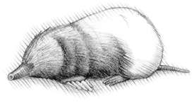
By flooding woodlands, the beavers have caused tall oaks and hickories to die. The stark, dead trunks of these trees still emerge from the marsh, or lie in the ooze, attracting turtles, blacksnakes, and garter snakes. The flashy, black-and-white pileated woodpecker (Dryocopus pileatus) stays busy extracting grubs and insects from the decaying bark. Birds normally associated with more northern climes, such as the magnolia warbler (Dendroica magnolia) and Canada warbler (Wilsonia canadensis), make their home here. The red-shouldered hawk (Buteo lineatus) finds easy prey among the grasses. Spring peepers, leopard frogs, tree frogs, and cricket frogs keep up a riotous chorus in spring and summer. The Glades is accessible by car or from the Chief Benge Scout Trail [Fig. 12(6)].
 Guest
River Gorge
Guest
River Gorge [Fig. 12(20)] To carve Guest River Gorge through the east end of Stone Mountain, the Guest River over the ages sliced a ragged, serpentine gash through the Pennsylvanian sandstone of rural Wise County. The sheer cliffs that rise 400 feet above the tumbling mountain river are estimated to be more than 300 million years old. The gorge lies near the southeastern edge of the Appalachian Plateau. The oldest rock, called the Lee Formation (323 million years old), lies in the bedrock. Rock of the Norton Formation in the sides is younger, estimated to be about 317 million years of age near the top. The Guest River—designated a Virginia Scenic River—begins above Norton on Indian Mountain. The 30-mile river flows past Coeburn, enters the gorge, and cascades over ledges and around huge boulders beneath sheer canyon walls. The Guest flows out of the gorge and empties into the Clinch River where Wise, Scott, and Russell counties meet.
Before the first white settlers arrived, Native Americans used the Guest River and gorge area for hunting, fishing, and tool making. Indians walked beneath the towering hardwoods and hemlocks and speared fish in the river as early as 9000 b.c. and as late as the mid-eighteenth century. Both coal and saltpeter were mined in the area. The coal was used for heating. Saltpeter was used to make explosives. In 1922, workers carved and blasted a short tunnel through the hard sandstone. A railroad was laid so that steam and later diesel locomotives could haul the coal and saltpeter through the gorge. In a few places, the cliffs were cut away for the railroad. For the most part, though, the gorge remains as nature created it.
After the train was no longer needed, Norfolk-Southern Railroad donated the abandoned railroad to Wise County which, in turn, donated it to the Jefferson National Forest. Rails and ties were taken up and trestles over the river were repaired by Flatwoods Job Corps students. Turning the railroad into a trail took the cooperation of the U.S. Forest Service, the Wise County Board of Supervisors, the Norfolk-Southern Railroad, the Virginia General Assembly and community activists. In 1994, the new Guest River Gorge Trail was dedicated.
The Guest River Gorge Trail. [Fig.
12(20)] Today the old railroad bed, a rails-to-trails conversion, provides
a level, broad, 5.8-mile passageway through the scenic gorge where, as late
as the 1980s, access was almost entirely limited to trains.
A brochure on this self-guided trail is available at the trailhead or by writing
the address above. Much of the trail will seem isolated from the rest of the
world, but expect occasional heavy day use in the first .5 mile down to the
railroad trestle across the Guest River. Local groups plan to build an exploratorium
and hands-on museum, perhaps on one of the high cliffs overlooking the Guest
River. Also in the plans are more access points and visitor conveniences such
as restrooms and pay phones.
River and trail meander through forests of hardwoods and hemlock, above rapids and waterfalls, and past ancient rock formations carved by wind and water. At one point, the Guest River Gorge Trail goes though the old train tunnel, named Swede Tunnel. Three rebuilt wooden railroad trestles safely span the Guest River and Crab Orchard Creek and offer unique views. Along the trail, devil's walking stick (Aralia spinosa) is abundant. This large shrub has spines on both leaves and stems. A member of the ginseng family, it produces white flower heads in July and August. A moist streamside under hardwood canopy is its favorite habitat. The round trip to the Guest River's confluence with the Clinch and back to the trailhead takes about a half day, allowing time to stop and wet a lure or catch a crayfish.
 Devils
Fork Trail System. [Fig.
12(21)] The soothing sound of water cascading over rocks. Quiet pools beneath
virgin hemlocks. Expansive vistas from remote overlooks on Little Mountain.
Rewards such as these await those who tackle the tough hikes of this trail system
southwest of High Knob.
Devils
Fork Trail System. [Fig.
12(21)] The soothing sound of water cascading over rocks. Quiet pools beneath
virgin hemlocks. Expansive vistas from remote overlooks on Little Mountain.
Rewards such as these await those who tackle the tough hikes of this trail system
southwest of High Knob.
The Devils Bathtub Trail goes up Devils Fork along an old railroad grade once used for carrying logs and coal from the slopes of Little Mountain. As hikers cross back and forth across the stream, they pass through old growth hemlock stands, see a rusting, abandoned railroad car, and watch water racing down rock chutes and swirling through the rock tub that gives the trail its name.
After 1.5 miles, at the Devils Bathtub, the hiker can double back to the parking lot or continue westward, following the Devils Fork Loop Trail up Corder Hollow to a 20-foot waterfall, passing many hollows and beautiful views. After 4.2 miles (5.7 miles from the start), the loop trail connects with Straight Fork Ridge Trail. The hiker can go left on this trail for 1.8 miles up Little Mountain to the upper trailhead at FR 237, or go right 1.6 miles down the mountain to finish the loop at the parking lot.
The lack of facilities and the rugged terrain make this an ideal trail for those who like a more remote experience. Two primitive camping areas (no water) are available on the loop trail, one at the lower west end and one about .7 mile west of the connection with the Straight Fork Ridge Trail.
Read and add comments about this page