Davidson River Area
[Fig.
26(10)] There is at least one spot in Western North Carolina where visitors
are as likely to float along the edge of a Forest Heritage National Scenic Byway
on an inner tube as they are to drive the route in a car. Cutting through a
picturesque section of the Pisgah National Forest just north of Brevard, the
Davidson River is the focal point for an active recreation area and one of the
district's most popular campgrounds.
 East
of the Pisgah Center for Wildlife Education, a host of tributaries—Laurel,
Shuck, Daniel Ridge, Cove, and Caney Bottom—flow together to create the
Davidson River. For the next 10 miles west, anglers show up in all seasons,
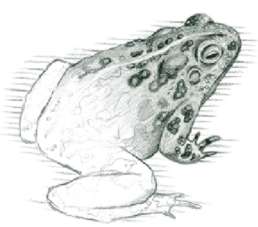
fishing this mountain stream for hatchery-reared and native brook trout (Salvelinus
fontinalis). No size limits or bait restrictions exist for hatchery-stocked
areas, but fishing in the natural trout water nearer the Davidson River Campground
is all catch and release. A detailed river map outlining changing restrictions
is available at the Pisgah Ranger Station across from the campground.
East
of the Pisgah Center for Wildlife Education, a host of tributaries—Laurel,
Shuck, Daniel Ridge, Cove, and Caney Bottom—flow together to create the
Davidson River. For the next 10 miles west, anglers show up in all seasons,
fishing this mountain stream for hatchery-reared and native brook trout (Salvelinus
fontinalis). No size limits or bait restrictions exist for hatchery-stocked
areas, but fishing in the natural trout water nearer the Davidson River Campground
is all catch and release. A detailed river map outlining changing restrictions
is available at the Pisgah Ranger Station across from the campground.
Though the river's consistent, shallow depth doesn't attract paddlers, it is
considered a prime tube-floating river throughout the summer. In addition to
the allure of the easy-flowing current, regulars are drawn by the cool water
and wooded banks that provide an ideal spot for rest or play even on summer's
hottest days.
A Davidson River Trail Guide, also available at the Ranger Station, lists nine
area hikes that range from short interpretive loops to full-day hikes and overnight
backpacking trips, all with starting points near the campground. The North Slope
Trail, one of the most accessible, is an easy day hike that runs from the bottomland
environment of sycamore and poplar up to the drier forests of primarily chestnut
oak (Quercus lyrata) on top of North Slope Ridge.
Campers don't have to venture far beyond the river's plateau to observe a variety
of birds in spring and summer. Mourning doves (Zenaidura macroura), blue-gray
gnatcatchers (Polioptila caerulea), American redstarts (Setophaga
ruticilla), and ruby-throated hummingbirds, among many others, are common
near the campground. Other birds less commonly spotted include hooded warblers
(Wilsonia citrina) and yellow-breasted chats (Icteria virens).
Peregrine falcons, which were successfully reintroduced to the area several
years ago, nest at nearby Looking Glass Rock and can sometimes be seen flying
overhead. An Eastern screech-owl (Otus asio) or great horned owl (Bubo
virginianus) may be heard after nightfall.
From Memorial Day through Labor Day and on weekends into the fall, the nonprofit
Cradle of Forestry in America Interpretive Association offers a diverse array
of programming at the Davidson River Campground. Focusing on local culture and
the area's natural history, activities include guided hikes, stream investigation,
and Friday and Saturday evening events such as square dancing and live bluegrass
music. Guest speakers on animal rehabilitation and special children's programs
are also presented.
- Directions: Exit the Blue Ridge Parkway at milepost 412. Travel south
on US 276 approximately 14 miles. The campground will be on the right, across
from the Pisgah Ranger Station. Or from Brevard, travel east on US 64/US 276
approximately 3 miles to the stoplight in Pisgah Forest; turn left and travel
north 1.2 miles on US 276. The campground will be on the left.
- Activities: Fishing, tubing, hiking.
- Facilities: 161 campsites which can accommodate tents and RVs, bathhouses
with warm-water showers and flush toilets, dump station, no electrical hookups.
- Dates: Open year-round.
- Fees: A fee is charged for camping.
- Closest town: Brevard, 4 miles.
- For more information: Pisgah Ranger Station, 1001 Pisgah Highway,
Pisgah Forest, NC 28768. Phone (704) 877-3265. Davidson River Campground,
phone (704) 862-5960; Camping/Recreation Center Reservations, phone (800)
280-2267.
Pisgah Center for Wildlife Education
[Fig.
26(12)] Pisgah Center for Wildlife Education is a new and modern facility
operated by the North Carolina Wildlife Resources Commission with a mission
to teach how human activities affect and are affected by wildlife and the natural
environment. The center is due to be finished in the summer of 1998, offering
to the public the 17-acre educational and interpretive center featuring exhibits,
programs, and hiking trails. It also serves as a gateway to the Wildlife Commission's
adjacent Pisgah Trout Hatchery, explaining the hatchery's operation and function
as well as the North Carolina Wildlife Commission's larger role in managing
the state's wildlife and inland fish populations.
 The
center is located at the base of an impressive geologic feature known as John
Rock. This dome-shaped outcrop is part of the larger rock mass, Whiteside Granite—a
390-million-year-old igneous rock mass that cooled and crystallized from molten
rock deep within the earth's crust. Several mountain-building episodes, followed
by weathering and erosion, exposed John Rock and nearby Looking Glass Rock.
John Rock is the centerpiece of the John Rock Scenic Area, a 435-acre area surrounding
the center. To reach John Rock, hike the Cat Gap Loop Trail, accessed from the
east end of the center's parking lot, for 1 mile until the junction with John
Rock Trail. The yellow-blazed John Rock Trail climbs steeply through hardwoods,
laurel, and shrubs en route to its namesake. Views of the fish hatchery, the
Davidson River valley, and the other monolith in the area, Looking Glass Rock,
are spectacular. A word of caution: water seeps from the mosses, making the
rock's surface slippery. Staff members at the center suggest backtracking the
trail to the parking lot, at least for first-time hikers, for a hike of approximately
5 miles round-trip.
The
center is located at the base of an impressive geologic feature known as John
Rock. This dome-shaped outcrop is part of the larger rock mass, Whiteside Granite—a
390-million-year-old igneous rock mass that cooled and crystallized from molten
rock deep within the earth's crust. Several mountain-building episodes, followed
by weathering and erosion, exposed John Rock and nearby Looking Glass Rock.
John Rock is the centerpiece of the John Rock Scenic Area, a 435-acre area surrounding
the center. To reach John Rock, hike the Cat Gap Loop Trail, accessed from the
east end of the center's parking lot, for 1 mile until the junction with John
Rock Trail. The yellow-blazed John Rock Trail climbs steeply through hardwoods,
laurel, and shrubs en route to its namesake. Views of the fish hatchery, the
Davidson River valley, and the other monolith in the area, Looking Glass Rock,
are spectacular. A word of caution: water seeps from the mosses, making the
rock's surface slippery. Staff members at the center suggest backtracking the
trail to the parking lot, at least for first-time hikers, for a hike of approximately
5 miles round-trip.
The theme of this state-of-the-art facility centers around "Mountain Streams,
Where Water and Life Begin," emphasizing the importance of clean water
to the environment, wildlife, and people. The flow of water is tracked from
its beginnings as rainfall and snow on mountains, down through the streams and
rivers of the Piedmont and Coastal Plain to the Atlantic Ocean, and eventually
to its reconversion into rain. Stations feature interactive displays, demonstrations,
and hands-on activities on the state's ecosystems designed in a manner that
allows visitors from across the country to relate the concepts to their own
ecosystems.
The Pisgah Center for Wildlife Education also serves as an outdoor classroom
and meeting place for environmental education workshops for the Wildlife Commission.
Outdoor exhibits focus on wildlife management and protection, fish culture,
and conservation education. Permanent and changing displays present general
scientific concepts illustrated through specific examples relating to the Blue
Ridge Mountains as implemented by the Wildlife Commission.
At the heart of the wildlife center, the outdoor interpretive exhibit on a
.5-mile loop walkway incorporates a mountain stream, native plant and animal
life, and the trout-rearing raceways. The raceway exhibit is one of three cold-water
facilities in the state devoted to raising trout. (Other state hatcheries produce
warm-water species including largemouth bass, striped bass, sunfish, and catfish.)
Hatchery stockings enhance the angling experience by providing more trout than
would be produced by natural reproduction.
During the spawning season at the hatchery, ripe eggs are hand-stripped from
female trout and milt (sperm-containing fluid) is stripped from the males. Once
the eggs are gently mixed with the milt and fertilized, they are placed in stacks
of shallow incubation trays where they receive a constant flow of cool, clean
water. The eggs begin to hatch about 30 days after fertilization. A newly hatched
fish is called a sac fry because, even though the fish has emerged from the
egg, it still feeds from the attached yolk sac. The young fish are kept inside
the hatchery for four to five months until they become fingerlings, 2 to 3 inches
in length. Fingerlings are then moved to outside raceways, elongated concrete
fish-rearing ponds with a constant flow of fresh water, where they are kept
for up to one and a half years. When the fish are old and large enough, they
are removed for stocking in public trout waters.
More than 400,000 trout weighing more than 180,000 pounds are stocked from
the Pisgah Forest Fish Hatchery each year. Hatchery-supported waters are stocked
with a ratio of 40 percent rainbow, 40 percent brook, and 20 percent brown trout.
- Directions: Exit the Blue Ridge Parkway at milepost 412. Travel south
on US 276 approximately 10 miles. Turn right onto FR 475; the center is 1
mile on the left. Or from Brevard, travel east on US 64/US 276 approximately
3 miles to the stoplight in Pisgah Forest. Turn left, and travel 5 miles on
US 276 to the junction with FR 475. Turn left; the center is 1 mile on the
left.
- Facilities: Exhibits, trails, raceways, auditorium, gift shop, restrooms.
- Dates: Mar.–Nov.
- Fees: None.
- Closest town: Brevard, 9 miles.
- For more information: PO Box 1600, Pisgah Forest, NC 28768. Phone
(704) 877-4423.
Art Loeb Trail
[Fig.
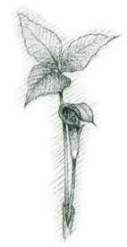
26(9), Fig. 27(2)] Blustery bald mountaintops, gaps filled with sun-scorched
grasses, river lowlands of bee-balm (Monarda didyma) and cone flower
(Rudbeckia hirta), and open groves of sourwood (Oxydendrum arboreum),
hickory, and maple. Those passionate about the Art Loeb Trail value it for its
diversity—a captivating mix of breathtaking vistas and peaceful valleys,
of challenge and tranquillity.
Designated a National Recreation Trail in 1979, this 30-mile trek through the
Pisgah National Forest was named for Arthur J. Loeb, an active hiker and former
leader of the 65-year-old Carolina Mountain Club. The Art Loeb Trail's four
contrasting sections, determined by the Forest Service, begin at the Davidson
River Campground and run northward. The trail connects with 13 other trails,
climbing to an elevation of 6,030 feet along the trail to the summit of Cold
Mountain on the north end. For a slightly less strenuous hiking or backpacking
experience with a lesser elevation gain, the trail can be hiked north to south,
starting at the Daniel Boone Boy Scouts Camp.
The Blue Ridge Parkway and several other roads and highways intersect with
the trail, providing access points for shorter, customized hikes. The trail's
first section begins in the cool, forested valley of the Davidson River, crosses
several streams, and passes through woods of locust and oak and undergrowth
of blackberry before winding to the summit of Rich Mountain. On the north side
of Pilot Mountain, at the beginning of the second section, pink azaleas bloom
in mid-May. Lower elevations feature the brilliant blossoms of dogwoods and
Fraser magnolias (Magnolia fraseri).
Black Balsam Knob and Tennent Mountain, in the trail's third section, both
provide spectacular panoramas at more than 6,000 feet before the trail enters
Shining Rock Wilderness. Though this federally preserved wild area is heavily
used, short paths that diverge from the Art Loeb Trail provide more of an isolated
backwoods experience. Northern harriers and rare golden eagles (Aquila chrysaetos)
can sometimes be seen on Black Balsam Knob. In the fourth section, the trail
descends to the source of Sorrell Creek, passing small waterfalls, blankets
of ferns, and wildflowers including painted trillium (Trillium undulatum),
umbrella leaf (Diphylleia cymosa), and golden Alexanders (Zizia aurea).
Campers may pitch tents most places along the trail. A Pisgah District Trail
Map plots Art Loeb's main route and a variety of connector trails through some
of North Carolina's most picturesque terrain.
- Directions: Exit the Blue Ridge Parkway at milepost 412. Travel south
on US 276 approximately 14 miles. The campground is on the right, across from
the Pisgah Ranger Station. Or from Brevard, travel east on US 276 approximately
3 miles to the stoplight in Pisgah Forest; turn left and travel north 1.2
miles. The campground is on the left. Once in the campground, take a left
before the bridge to go to the Art Loeb Trail parking lot. For a less strenuous
access, exit Blue Ridge Parkway at milepost 420.2 onto FR 816. Travel 1 mile
to parking area.
- Trail: Approximately 30 miles one-way.
- Elevation: 5,500 feet (excluding the connector trail to Cold Mountain).
- Degree of difficulty: Strenuous.
- Surface and blaze: Varied surface; white blazes except within Shining
Rock Wilderness (last 8 miles), where blazes are not allowed.
- Closest town: Brevard, approximately 4 miles.
- For more information: Pisgah Ranger Station, 1001 Pisgah Highway,
Pisgah Forest, NC 28768. Phone (704) 877-3265.
Richland Balsam Self-Guiding Trail
[Fig.
26(3)] Perched near the top of the Great Balsam range, Richland Balsam
Overlook at 6,053 feet is the highest point on the Blue Ridge Parkway. The self-guiding
trail from this overlook winds through spruce-fir forests, past flora and fauna
more akin to Canada than the South, to the 6,292-foot summit of Richland Balsam.
The experience is tarnished somewhat by the dead and downed trees surrounding
the summit, where the struggle between the Fraser fir and the balsam woolly
aphid is painfully evident.
The brighter side of this story is, of course, that life's natural cycle continues.
Dead trees open space to new life that would otherwise not get enough sun, allowing
blackberry and elderberry (Sambucus pubens) to thrive, ferns and trees
to sprout, and the forest to continue its renewal. Rotting logs contribute to
the cycle, too, providing homes for beneficial insects, rodents, salamanders,
and other wildlife. Wildflowers and shrubs along the trail vary with the season—speckled
wood lily (Clintonia umbellulata) in May, climbing false buckwheat (Polugonum
scandens) in July, and hobblebush (Viburnum llantanoides) and red-berried
elder (Sambucus racemosa pubens), both sporting white spring flowers
that develop each fall into deep red berries, a favorite with the birds.
Other birds known to inhabit the region include the winter wren (Troglodytes
troglodytes), red-shouldered hawk (buteo lineatus), yellow-bellied
sapsucker, black-billed cuckoo (Coccyzus erythropthalmus), and pine siskin
(Spinus pinus). The red squirrel (Tamiasciurus hundsonicus) lives
here and the tracks of white-tailed deer have been spotted in the soft, rich
soil from which "Richland" takes its name.
- Directions: Blue Ridge Parkway milepost 431.4.
- Activities: Hiking.
- Facilities: Parking area, self-guiding trail.
- Dates: Open year-round; Parkway closes often in the winter.
- Fees: Trail guide for sale at the trailhead.
- Closest town: Waynesville, approximately 18 miles.
- Trail distance and configuration: 1.5-mile loop trail.
- Elevation: 6,292 feet at the summit.
- Degree of difficulty: Moderate to strenuous.
- Surface and blaze: Forest floor, no blaze.
The Rhododendron Garden and Arboretum at Haywood
Community College
[Fig.
21(27)] Dazzling white to lilac. Creamy yellow then magenta. Flaming
red and back to white. The honey bees' dizzying excitement is contagious at
Haywood Community College's Rhododendron Garden. The bees are the lucky ones.
They get to come every day and watch 75 varieties of rhododendron unfold from
early April through May. The garden was designed to extend the blooming season
as long as possible, but once the rhododendron have given their all, colorful
wildflowers and cultivars take over.
The Rhododendron Garden follows a delicate rhythm in harmony with nature. Careful
landscaping gives the effect of a long, leisurely walk deeper and deeper into
the forest even though the walk only measures .33 mile. The woodland canopy
of tall oak, poplar, and hickory filters sunlight onto the rhododendrons which
filter it yet again onto the herbaceous layer below, dense with ferns and wildflowers
such as bleeding heart (Dicentra eximia), foamflower (Tiarella cordifolia),
and bloodroot (Sanguinaria canadensis).
At the heart of the garden lies Ogden Circle, a council ring 24 feet in diameter
surrounded by four walls tapering up from the earth. The walls define four paths
that cross here, radiating from a centered millstone. Tall, columnar boxwoods
punctuate the circle. Students contribute hanging baskets, wooden flower boxes
of impatiens and lobelia, and a living sculpture of annual plants atop the millstone.
Structures within the garden, such as the wooden arbor supporting Dutchman's
pipe vines or the split-rail fences dividing cinnamon ferns (Osmunda cinnamonea)
and periwinkle, work with the native plants. The Rockery hosts lichen- and moss-covered
rocks, thick ferns, and wildflowers. A virtual wall of Eastern hemlock glows
bright green with tips of new spring growth. Queen Anne's lace (Daucus carota)
grows near the trail's end.
The Rhododendron Garden is part of the 80-acre Haywood Community College Campus
Arboretum which serves as a living laboratory for the students, faculty, and
community. In addition to the Rhododendron Garden, the Campus Arboretum includes
the Freedlander Dahlia Garden (peaks in September), Class of '74 Rose Garden
(July), new Water Garden, dwarf conifer collection, vegetable gardens, perennial
garden, herb garden, fruit tree orchard, greenhouse conservatory, and picturesque
Mill Pond surrounded by weeping willow (Salix babylonica) and river birch
(Betula nigra).
Landscape architect Doan Ogden designed the campus for industrialist A. L.
Freedlander, who donated funds for the college with the stipulation that the
property's sizeable oak forest be preserved. An early inventory recorded 880
trees including 22 native species (most averaging 100 years old) to which the
Campus Arboretum staff has added 100 new species of trees, shrubs, and ground
covers.
- Directions: From US 19-23 in Clyde (5 miles east of Waynesville and
25 miles west of Asheville), take the Jones Cove Road Exit and follow signs
to Freedlander Drive and the campus entrance. Pass the Mill Pond on the right,
turning into the third driveway on the left (opposite Sawmill Road on the
right). Follow signs to Rhododendron Garden.
- Dates: Open year-round.
- Fees: None.
- For more information: Haywood Community College, Freedlander Drive,
Clyde, NC 28721. Phone (704) 627-2821.
Cataloochee Ski Area
[Fig.
21(26)] High atop Moody Top, Cataloochee Ski Area holds the distinction
of being the first ski slope in the South. Tom and Judy Alexander opened the
slope in 1954 adjacent to their famed Cataloochee Ranch, a 1,000-acre resort
that got its start in the late 1920s as North Carolina's first tourist camp
in the newly legislated Great Smoky Mountains National Park. Five years later,
when the federal government consolidated its holdings in the park, the Alexanders
had to move and took the valley's name with them. They settled across the divide
on Fie Top, where the elevation surpasses 5,000 feet and an ocean of breathtaking
mountain ranges surrounds. Cataloochee, after all, is a Cherokee word meaning
"wave upon wave."
The ski area is no longer part of the ranch, but it continues to offer excellent
skiing on nine slopes. At 5,400 feet with a vertical drop of 740 feet, Moody
Top is the highest. Other less-daunting slopes suit beginners and intermediates
better; skiing instruction is also available.
- Directions: From I-40 7 miles west of Clyde, take Exit 20 from the
west or Exit 27 from the east. Cataloochee is 4 miles off US 19 overlooking
Maggie Valley.
- Activities: Skiing, hiking trails to the adjacent Great Smoky Mountains
National Park.
- Dates: Winter season, hours vary.
- Facilities: Lodge, ski rentals, skiing school, snow-making equipment.
- Closest town: Maggie Valley, 4 miles.
- Elevation: 5,400 feet at the summit.
- For more information: Route 1, Box 502, Maggie Valley, NC 28751.
Phone (800) 768-0285 or (704) 926-0285.
Holmes Educational State Forest
[Fig.
25(7)] Created during the Depression-stricken 1930s, Holmes Educational
State Forest got its start as a seedling nursery run by the Civilian Conservation
Corps (CCC). In 1972 the land received both a new name and a new purpose as
one of six educational forests in North Carolina. Named in honor of John S.
Holmes, one of the state's first foresters, the 235-acre forest treats visitors
to a series of well-marked trails that, as they loop through the forest's abundance
of hardwoods and wildflowers, are as informative as they are scenic.
The rugged geology of the area consists primarily of gneiss metamorphosed from
granite approximately 430 million years ago by the forces of continental collision.
Flecked with flaky, black mica, this gneiss is sometimes banded by layers of
rock with eye-shaped depressions of minerals. Accessible by a steep .25-mile
trail, Wildcat Rock is a good example of these outcroppings that typify the
region.
An altitude change of 450 feet within its boundaries allows Holmes to support
a wide variety of plant life. Hardwoods such as oak, hickory, and red maple
flourish in the uplands while lower in the forest, coves of yellow-poplar, basswood
(Tilia americana), and silverbell (Halesia carolina) thrive. Flowering
dogwood grows throughout. Lovers of wildflowers will also find troves of colorful
specimens. More than 50 species of blossoms have already been identified trailside,
among them rhododendron, flame azalea (Rhododendron calendulaceum), trout
lily (Erythronium americanum), yellow lady slipper (Cypripedium calceolus),
jack-in-the-pulpit (Arisaema triphyllum), trillium, bloodroot, and violet.
In addition to the trail leading to Wildcat Rock, Holmes offers four other
trails. On the Talking Tree Trail, a push of a button prompts trees to "tell"
stories about themselves and the forest in which they live. Forestry practices
are explained on the 3.5-mile Forest Demonstration Trail, while the handicapped-accessible
Crab Creek Trail features equipment such as a helicopter and a fire tower used
in battling forest fires. A 200-foot boardwalk crosses trillium-laden wetlands
on the Soil and Water Trail. Ranger-conducted programs are also available to
groups visiting the forest.
- Directions: From the junction of US 64 and US 25 in downtown Hendersonville,
travel south on US 25 for .5 mile. Turn right at junction with Kanuga Road,
which later becomes Crab Creek Road (NC 1127). Continue 9 miles to the forest
entrance.
- Activities: Hiking, volleyball net, horseshoe pits, picnicking.
- Facilities: Educational trails and exhibits, 2 amphitheaters (each
30-person capacity), picnic shelter (for 80–100 people) with massive
stone fireplace, 20 picnic tables and grills, restrooms, walk-in tent campsites
on mountaintop (call to reserve a site).
- Dates: Mid-Mar.–Fri. before Thanksgiving.
- Fees: None.
- Closest town: Hendersonville, 9 miles.
- For more information: Holmes ESF, Route 4, Box 308, Hendersonville,
NC 28739. Phone (704) 692-0100.
Read
and add comments about this page