 Lake
Alpine Recreation Area
Lake
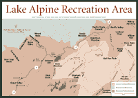
Alpine Recreation Area [Fig. 21, Fig. 22, Fig. 23, Fig. 24] Created in 1891, the 900,000-acre Stanislaus National Forest is one of the oldest national forests in California and the U.S. Two mammoth wildernesses spread across the upper elevations of the Stanislaus. The imposing granite of the 160,000-acre Carson-Iceberg Wilderness and the volcanic-dominated Emigrant Wilderness, which covers 113,000 acres.
Highway 108 passes between the two wildernesses through a 5-mile gap. At the Sierra crest, Highway 108 crosses the Sierra crest through Sonora Pass to the dry, high-desert conditions on the east side of the mountain range. The area around the pass is where the Sierra shows off its high elevation. At Carson Pass, the 11,750-foot Leavitt Peak and the 11,462-foot Sonora Peak stand to the south. Leavitt is in the Emigrant Wilderness; Sonora is in the Carson-Iceberg.
A little farther west down the slope, the Wild and Scenic Tuolumne River runs for 28 miles in the southern part of the forest. Though the river is dammed to the east—forming Hetch Hetchy Reservoir in Yosemite National Park—there are no other dams on the river through Stanislaus National Forest. The river is considered a challenge even for the most experienced rafters and kayakers.
Recreation areas include Pinecrest Lake on Highway 108 and Lake Alpine along the Highway 4 corridor. There are also ski resorts, including Dodge Ridge Ski Area and Mount Reba Ski Area. In the foothills, east of Stanislaus, there are historic sites, such as the Colombia State Historic Park. The nearby Red Hills also provide a nature preserve that tells visitors about the soils in California.
[Fig. 22] Glacial history can be a consuming fascination in the 160,000-acre Carson-Iceberg Wilderness. Straddling the crest of the Sierra, with one foot in the Toiyabe National Forest and one in the Stanislaus, the Carson-Iceberg displays evidence of a glacier that existed about 26,000 years ago. Hiking, camping, backpacking, and sight-seeing are the reasons people come to this backcountry. And the glacial past is what created the sights.
In places such as Disaster Creek and Arnot Creek canyons, two glaciers flowed down to meet another larger body of ice flowing down the Stanislaus River. The one on the North Fork Mokelumne River was 1,300 feet deep, covering such present-day features as Highland Lakes. It was 500 feet thick even over Ebbetts Peak, more than 10,000 feet high.
The granite glacial basins are only part of the fascination, though. Between 10 and 20 million years ago, volcanic eruptions created lahars, or volcanic mudflows. They continued sporadically until just about 100,000 years ago, and they may occur again some day because the magma has not completely cooled.
Many lava flows rolled down rivers, such as the Stanislaus River, where they bonded with the granitic rock. As in other Sierra locations where this happened, the processes of erosion lowered the surrounding landscape, leaving a flattop or Table Mountain in the ancient stream beds. Such an andesite remnant, a 9 million-year-old Table Mountain, can be seen in the lower elevations at the junction of Highway 108 and Highway 120.
The Dardanelles is considered the most striking volcanic feature of this wilderness, and it is a prime example of this upside-down geology. A lava flow of perhaps 2,000 feet in depth swallowed this area about 10 million years ago, forming the Dardanelles palisade at the bottom of a canyon. Because of the erosion all around it, the Dardanelles today stands 3,000 feet above the Stanislaus River.
Lava flow also is associated with the 150,000-year-old basalt formation known as Columns of the Giants, near Sonora Pass on Highway 108, one of two main routes to Carson-Iceberg. The northerly route, Highway 4, runs between the Mokelumne Wilderness to the north, and the Carson-Iceberg to the south.
The Carson-Iceberg's higher elevations are considered alpine—9,900 feet and higher in this part of the Sierra. Only the hardiest vegetation can survive the long, cold winters and the eight-week growing season in the warmer weather. Scientists refer to this region as the dwarfed timberline belt, where trees and shrubs do not reach their full height.
The rocky soil is thin and the surface is blasted by freezing winds, even in May and June. The cutleaf daisy (Erigeron compositus) adapts by spreading along the granite surfaces and wedging roots into cracks and crevices. The sky pilot (Polemonium eximum) is another example, using its leaves to insulate the flowering stock.
Flowers in these harsh conditions are formed by buds that grew the previous year. So, a cold Sierra summer could mean few flowers a year later. Examples of flowers include the alpine buttercup (Ranunculus eschscholtzii), alpine paintbrush (Castilleja nana), rosy stonecrop (Sedum rosea), and alpine goldenrod (Solidago multriadiata).
Visitors will not find a lot of animals in these forbidding conditions. Occasionally a rare red fox (Vulpes fulva) may wander through the talus in high elevation areas. The yellow-bellied marmot (Marmota flavientris)—an inspired thief around any hiker who leaves food unsupervised—and the alpine chipmunk (Eutamias alpinus) are about the only companions that high-elevation travelers will find up here.
The Carson-Iceberg gets its name from the Carson River, named after adventurer and explorer Kit Carson, and the distinctive granite formation called The Iceberg in the southern part of the wilderness near Clark Fork Road. As the mining boom of the 1840s became the bust of the 1860s, grazing took hold in the area. Along the Driveway Trail in the Silver Valley area, hikers will see something the Basque sheepherders called an arri mutillak or stone boy, basically a pile of rocks the sheepherders made to pass the time.
More than 100 miles of trails are spread throughout, giving visitors the opportunity for long backpacking tours or short jaunts. Motorized travel is not allowed.
[Fig. 21(5)] This hike can be done as a backpack, but many people consider it a day hike. The views of the Dardanelles, an ancient lava flow that engulfed the area many thousands of years ago, are spectacular, and many people enjoy taking their time with this hike.
There are places such as Lost Lake to stop and swim. Don't miss the views of Donnel Lake and Sword Lake.
Look for the porcupine (Erethizon dorsatum). They nest in tree cavities and rock crevices near this trail. Porcupines are fine tree climbers, but their sharp, protective quills allow them to be slow of foot and wit. About the only predator that seems to have no trouble with the quills is the fisher (Martes pennanti). But most other predators prefer their prey to be a little less complicated. Hikers should likewise look but not get close enough to touch.
Lake
Alpine Recreation Area [Fig. 21(6), Fig. 22] The sights in the warmer season at Lake Alpine are likely to include fishing boats. This heavily timbered section of the Stanislaus National Forest is the backdrop for fishing in a 45-foot deep lake that is stocked with more than 20,000 rainbow trout (Oncorhynchus mykiss) annually.
Motorized boats are not allowed to go faster than 10 miles per hour. Overnight mooring is prohibited and so are motorized boats after sundown.
Along with nearby Emigrant Trail, the 3.5-mile Lakeshore Trail is where the tourists go. It's an easy walk on an established trail with only brief ascents next to this body of water at 7,350 feet in elevation. The lake is a hydroelectric facility built by Pacific Gas and Electric Company.
[Fig. 21(7)] The granite boulders on Osborne Point indicate a glacier that probably stood about 500 feet above the Lake Alpine Basin in the last 26,000 years. Those visitors with a geologist's eye will note the exposed layers of volcanic sandstone deposited many millions of years ago by an ancient stream.
This hike is an easy, half-hour walk for most people. The walk rewards visitors with views of wildflowers in the dark volcanic soil.
Looking up from the geology and the wildflowers, visitors will see the Dardanelles and the Dardanelles Cones, features created by lava flows 10 million years ago.
[Fig. 21(8)] Clark Fork, on the southwest side of the Carson-Iceberg Wilderness, provides a camp with 13 sites where campers can keep horses. There's even a watering trough for horses. So decisions about whether to pack the extra food, the more comfortable sleeping pad, and the heavier tent are rendered much simpler for those who ride horses. Horses can easily carry items that backpackers consider to be too heavy to carry—such as a bulky but protective tent.
Outside of the horse camp, there's nothing particularly intriguing about this camping complex, except that the facilities are an impressive platform from which to launch into the wilderness. At 5,600 to 6,100 feet in elevation, it is a little cooler in the summer. The area has more than 150 campsites, including a recreational vehicle dump station and showers.
The Dardanelles and other volcanic features wait in the distance. For those perceptive enough to see it, the end of a massive moraine can be detected where the Clark Fork and the Middle Fork of the Stanislaus River meet. It is evidence of a glacier that extended all the way from the Dardanelles Cones, several miles northeast.
Fishing is also a passion in this area. Clark Fork River is stocked annually, and the Cottonwood Creek day-use area is 3.5 miles from the Highway 108 and Clark Fork junction. Barbecuing is allowed, but no overnight camping or campfires.
[Fig. 21(9)] Columns of the Giants is a basalt formation that is probably 400 feet thick. It formed more than 100,000 years ago in the Middle Fork Stanislaus River canyon, where wildflowers now bloom on the riverbanks.
Adventurous travelers will climb to the top of the basalt and see the fine polishing of previous glacial ages and the erratics the ice flows deposited. But be careful crossing a steep gully to the left side of the ancient volcanic flow.
The walk to the columns is far less eventful. Most people will traverse it in minutes and enjoy a short nature tour on the way to the basalt formation. The U.S. Forest Service has provided information about the formation at the end of the trail.
The Lake Alpine Basin is above 7,000 feet, so it often receives more than 30 feet of snow in winter. Several recreation opportunities are available for skiers, snowmobilers, and those who just want to play in the snow.
The Lake Alpine Basin offers a 3.5-mile loop trail around Lake Alpine. The trailhead is marked on the south side of Highway 4. This trail can be slick and difficult. Only intermediate to advanced skiers are encouraged to use it.
But there are other opportunities for skiers of all skill levels at nearby Lake Alpine Sno-Park. There are 8 miles of groomed snowmobile trail along Highway 4 from the park to Mosquito Lakes. The trail is separated into three distinct sections.
First, beginners can use the 0.75-mile trail to Lake Alpine. Do not ski on the frozen lake. Ice is unsafe in this area. In 3 miles, skiers reach Cape Horn Vista, a slow, easy uphill climb from Lake Alpine. It will take intermediate skiers about half a day, and the 300-degree view is spectacular.
The last 4-mile segment is an all-day affair in a gradual climb to Mosquito Lakes. Stay to the right as snowmobiles come through.
The trail to Pine Marten and Silver Valley campgrounds is about 0.5 mile of flat, groomed snowmobile trail along the east end of Lake Alpine. The unmarked trails are easy to follow and provide a good course for beginners.
About 0.5 mile west of Lake Alpine on the highway, Bear Valley Cross Country Area has an extensive trail system with 30 separate, groomed courses. Trailside huts, picnic tables, and food service are available as well as ski rentals and instruction.
About 5 miles west of Lake Alpine along Highway 4, Big Meadow Nordic Ski Trails offer ungroomed Nordic courses. Snowmobiles are prohibited. Beginner trails wind through the campground. The intermediate and advanced trails follow the rugged, scenic rim of the Stanislaus River Canyon.
For information on any of these trails, contact the Calaveras Ranger District at (209) 795-1381. Maps and brochures are available, as well as information about other cross-country skiing areas on snow-bound forest service roads.
Farther west, about 12 miles, some trails can be found at the Calaveras Big Trees State Park. For information about the trails, call (209) 795-2334.
[Fig. 23] This is one of the Sierra's better examples of a lake with a short but busy past. Cradled in a meadow that emigrants called Strawberry Flat and rimmed with granite outcroppings, Pinecrest Lake is the last in a series of dams constructed on the South Fork of the Stanislaus River for mining and hydroelectric power. The Tuolumne County Water and Power Company built the first dam called Big Dam 7.5 miles upstream of the present one in 1856.
The purpose was to divert water via ditches and flumes to the mining claims in and around Columbia, California. The second, called Middle Dam and sometimes called Upper Strawberry Lake Dam, was also built in 1856. The third, located 0.5 mile upstream from the present, was also built in 1856.
The present dam at Pinecrest, previously called Lower Strawberry Reservoir Dam, was built by Sierra and San Francisco Power Company (to whom Tuolumne County water and Power had sold the dam in 1916 for the purpose of providing cheap hydroelectric power).
Pinecrest's history goes back a little further. Jedediah Smith made the first recorded crossing of the Sierra by white men in early spring 1827 at the Stanislaus River in what today is known as the Stanislaus National Forest. Smith's party veered from the northern banks of the Stanislaus—not far from present-day Pinecrest—and climbed the foothills up into the pines. Eventually, they found the granite and packed snow of ridgelines. They passed through the high Sierra, exiting the west side near the current site of Ebbetts Pass on Highway 4.
At the time Smith passed through, the area was inhabited by Native Americans (Miwok). The trail emigrants followed past Pinecrest was called the West Walker Route later to be called the Emigrant Trail. The emigrants called Pinecrest's meadow Strawberry Flat because of the wild strawberries (Frageria virginiana) that grew there.
Situated just above the foothills at 5,600 feet, the Pinecrest area is painted in wildflowers at a time when lower elevations are beginning to swelter. The area's mid-July wildflowers include such plants as aster (Aster alpigenus), water hemlock (Douglassi), wild strawberry, buttercups (Ranunculus), clover (Trifolium), and elderberries (Sambucus).
The wildflowers accent the thick coniferous forest surrounding the area, typical of Sierra elevations just above the foothill level. Trees in the area include white fir (Abies concolor), incense cedar (Calocedrus decurrens), and sugar pine (Pinos lambertiana).
By Sierra standards, Pinecrest is a small lake, with 18,000 acre-feet of water. (One acre-foot is 325,900 gallons, or enough to supply the average California family for 18 months.)
The U.S. Forest Service's Summit Ranger District station, on Highway 108 about 1 mile from Pinecrest Lake, has information about a replica village of the Central Sierra Miwok, the most recent Native Americans to inhabit the area over the last 9,000 years. The replica is across the street from the ranger station and open to forest visitors at no charge. Visitors can walk along the 0.25-mile Shadow of the Miwok Trail, which is a loop through the replica village with interpretive signs posted along the way.
[Fig. 23(2)] The Bourland Trestle is considered a one-of-a-kind narrow-gauge logging railroad trestle because it is the last still standing in the western United States. Built in 1922, it was located 43 miles from the mill in Tuolumne City. The Westside Lumber Company system owned and operated it until 1960.
The trestle, 75 feet high and 315 feet long, was so vital to loggers that a watchman was posted at all major bridges to watch passing trains and check for sparks. Fire was a big concern. Ironically, a watchman's cabin remained right beside the trestle until it burned in the 1980s.
Today, the goal is to convert the trestle into a safe pedestrian bridge. It was partially stabilized in 1995, but a lot of work is still necessary. Recent storms have caused further damage to the trestle. Still, the trestle is a nice picnic spot at the end of a drive, hike, or bike.
[Fig. 23(1)] Dodge Ridge skiing provides 1,600 feet of vertical drop from 8,200 feet at the ridgetop to 6,600 feet at the base. The terrain accommodates three levels of skiers: beginner (20 percent of the runs), intermediate (40 percent), and advanced (40 percent).
There are 60 trails, the longest being 2 miles. A Nordic 11-kilometer cross-country course is designed for beginner to intermediate skiers. A new fixed grip quad chairlift has 159 chairs moving at 450-500 feet per minute, making it the fastest chair at Dodge. The entire Dodge Ridge lifts system has recently increased its carrying capacity of 13,600 per hour to 15,700. It is served by 12 lifts total.
Other skiing opportunities in the Stanislaus National Forest include 22.8 miles of Nordic skiing on U.S. Forest Service trails. That skiing is free. Call the Summit Ranger District, (209) 965-3434, for more details.
[Fig. 24(2)] In California, where exotic vegetation has taken over much of the open range and foothills, the Red Hills area stands as important stronghold of native perennial bunchgrasses. The unusual soils that provide a refuge for these bunchgrasses also support a unique plant community with many rare species. The federal government so valued the vegetation, soil, and animals that the Red Hills were set aside as an Area of Critical Environmental Concern or a "biological island."
The secret is the serpentine soils. The Red Hills Management Area is in the western tectonic block of the Sierra Nevada metamorphic belt. The hills contain much of the Tuolumne ultramafic complex, one of the largest exposures of serpentine rocks in the Sierra Nevada metamorphic belt. Nearly the entire area is underlaid by dunite, a variety of peridotite consisting of dark green olivine and minor chromite, which has been partly or entirely serpentinized to antigorite magnesite-magnetite.
In many similar foothill areas without the serpentines, the native perennials have been mostly replaced by exotic annuals. The important native perennial species include California oniongrass (Melica californica), big squirreltail (Sitanion jubatum), and pine bluegrass (Poa secunda).
Hikers in the Red Hills will be able to identify virtually the only tree species—foothill pine (Pinus sabiniana), which is found throughout the Red Hills in low densities. Buckbrush (Ceanothus cuneatus) comprises a majority of the shrub cover. Other shrubs include toyon (Heteromeles arbutifolia), coffeeberry (Rhamnus tomentella,) chamise (Adenostoma fasciculatum), hollyleaf redberry (Rhamnus ilicifolia), California yerbasanta (Eriodictyon californicum), and manzanitas (Arctostaphylos spp.).
Visitors also will be able to see California verbena (Verbena californica), a Red Hills endemic, meaning it is found nowhere else in the world. It is confined to short stretches of the mostly intermittent streams that run through the Red Hills. These stretches of the creeks remain moist year-round due to groundwater seepage. Permanent pools in these riparian zones support the rarest animal found in the Red Hills, a minnow called the Red Hills roach. These tough little fish can survive the elevated temperatures and low oxygen levels of these small pools in summer.
California verbena and Layne's butterweed are two plants that grow in the Red Hills that are listed under the federal Endangered Species Act. In addition, the Red Hills put on a spectacular display in the early spring when the annual wildflowers bloom.
Visitors can see most of the Red Hills on various loop trails, which total about 17.3 miles. The hiking is easy on open footpaths and gentle slopes.
The Red Hills Management Area includes 7,100 acres of public land located near the intersection of Highways 49 and 120 just south of the historic town of Chinese Camp in Tuolumne County. The Red Hills came into federal ownership along with most of California with the signing of the Treaty of Guadalupe Hidalgo in 1848 to officially end the war with Mexico.
The area is still in federal ownership simply because no one wanted the land in the days when it was government policy to dispose of public property. There was little or no gold associated with the serpentine rocks, and crops wouldn't grow properly in the serpentine-derived soil.
The Red Hills are mostly used for recreation and education. Important activities include wildflower viewing, nature study, hiking, horseback riding, and amateur prospecting. To protect the fragile resources of the area, in 1991 target shooting and off-road vehicle use were prohibited on public land in the Red Hills.
[Fig. 23] Once known as the "Gem of the Southern Mines," gold miners hauled out $500 million worth of gold (at today's value) between 1850 and 1870. Columbia, at the time, was California's second largest city.
Columbia is so well preserved today because it was never completely deserted. Since 1945, when the state decided to protect the old buildings, the town's old Gold Rush-era business district has remained intact with shops, restaurants, and two hotels. Proprietors do their business in period clothing.
There are opportunities to ride a mud wagon (which is a replica of the ones used in the 1800s), hire a "fine steed" for a horseback ride through the area where prospecting took place, pan for gold, or tour an active gold mine. The two-story brick schoolhouse and cemetery still overlook the town.
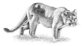
Visitors also can take a short stroll on trails in the area where it is common to see mule deer (Odocoileus heminous). Though these creatures are usually quite good at hiding in brushy cover, some have become acclimated well enough to the people in the area that they do not hide themselves very well. Mountain lions (Felis concolor), chief predators of the deer, have benefited greatly, thinning many herds.
Visitors are advised not to feed the deer and not to allow small children to stray very far from adults.
 Calavaras
Big Trees State Historic Park
Calavaras
Big Trees State Historic Park [Fig. 23] The largest redwood in Calaveras Big Trees State Park is the Louis Agassiz Tree in the South Grove. It is one of many large, historic reasons to visit this park along Highway 4. Agassiz Tree is 250 feet tall—not a record-setter—but its diameter is 25 feet at a height of 6 feet above ground level. The diameter is not a record-setter either, but the tree is about 2,000 years old and is a lot of wood.
The largest tree in the North Grove is the Empire State Tree, which is 18 feet in diameter 6 feet above the ground. The size of these giant sequoia (Sequoiadendron giganteum) is a little difficult to comprehend, even standing in the parking lot looking at them. It is not a bad idea to have a friend or family member stand fairly close to one of the fallen giants along the many short trails in the park to put the trees in perspective.
How did these trees get here? About the time of Christ, some slender seedlings, looking very much like blades of grass, reached out of the soil in the Central Sierra Nevada. The radicle or root also reached down into the soil. After a few days, the empty shell of the seeds popped off, and several little giant sequoia, the largest living thing on earth, began life. Though germination is rare under ordinary, natural conditions, hundreds of these redwoods spread through midelevations of the Sierra's western slopes, but only a few stands survived logging in the nineteenth century. Two of these groves are found at the Calavaras Big Trees State Historic Park where some of the largest giants in the world still survive.
Around the Calaveras trees, as in many places on the western slope, wildflowers appear on the sunnier, south-facing slopes first, then in lightly shaded or moister areas. Rangers remind people not to pick the flowers. Some of the more popular flowers include five spot (Nemophila maculata), Sierra lupine (Lupinus grayii), manzanita (Arctostaphylos manzanita), Mariposa lily (Calochortus), and western wall flower (Erysimum capitatum).
The giant sequoias, also known as Sierra redwoods, are the largest trees in the world, often ranging between 250 and 300 feet tall. The tallest has been measured at about 325 feet. But people also pause at the trees' width. They are measured at about 5 or 6 feet from the ground. Their diameters range to 30 feet and more. Their circumferences, the distance around the tree, can be more than 90 feet, or about 30 yards on a football field.
The largest tree in the world—which refers to volume, not just height—is the General Sherman Tree in Sequoia-Kings Canyon National Parks. It is 272 feet tall and is 36 feet in diameter at its base. A Sierra redwood of similar dimensions may contain enough wood to build 40 five-room homes, weigh 4,000 tons, and be as tall as the Statue of Liberty.
The giant sequoias, or "big trees" as they are known, are scattered between 4,500 feet and 8,000 feet on unglaciated ridges. They are found as far north as Placer County, west of Lake Tahoe, and as far south as the Southern Sierra in Sequoia-Kings Canyon National Parks, site of the largest remaining groves in the world. The Calaveras park groves are the next largest.
The trees need moist conditions, but they do not develop in areas of extreme cold. The trees can survive thousands of years because of the tannin in their bark. The tannin stops wood-boring insects and fungi.
But the bark itself is also a formidable defense. It is a dry, tough bark that is between 2 and 4 feet wide. It has no sap, which is flammable. Even when fire somehow gets through the bark, the tree remains alive and standing as long as some living wood is still present.
 Emigrant
Wilderness
Emigrant
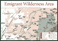
Wilderness [Fig. 23] Walking through the Emigrant Wilderness is a stroll through the many stages of the Sierra's past. People hike, camp, and see the geologic sights in this wilderness.
The metamorphosed pendant jutting out from the batholith at Bigelow Peak near the Yosemite National Park line gives a hint of the pre-Sierra history. About 10 percent of this wilderness contains visible Paleozoic sedimentary rocks such as shales, limestones, and siltstones.
Volcanic terrain—in the form of rhyolite, basalt, andesite tuffs, and latite—is apparent as well. But, like much of the Sierra, granite is the main feature here. In the last 2 million years, glaciation honed the salt-and-pepper coloration. The quartz monzonite and granodiorite are common.
The Emigrant, with its drainage basins and life zones, is a typical 113,000-acre slice of the Central Sierra. The wilderness ranges in elevation from about 5,000 feet, about as high as one would find foothill vegetation, at Cherry Reservoir at the southwestern edge of the wilderness to 11,750-foot Leavitt Peak on the northeast shoulder of the Stanislaus National Forest.
The vegetation belts start with the dominant tree species. Sugar pine (Pinus lambertiana), Douglas fir (Pseudotsuga menzlesii), white fir (Abies concolor), incense cedar (Calocedrus decurrens), and black cottonwood (Populus trichocarpa) are abundant, many gathered in almost unnaturally close quarters in the elevations between 5,000 and 7,000 feet in the wilderness.
Fire suppression stopped the natural thinning process of burning for most of this century. Historically, fires have burned intermittently in this and other Sierra forests. Fires vary in intensity depending on the amount of vegetation available to burn, weather conditions, and the season.
If fires remain "cool"—smaller flames burning brush and understory vegetation without reaching the thick canopies of mature trees—they are actually very beneficial and necessary in the Sierra. By clearing excess vegetation, the fire bares the soil needed by plant seedlings.
In a cool fire, burned material still carries potassium, phosphorus, magnesium, and nitrogen, which are necessary for plant growth. The soil benefits from such fires. Hot fires, which burn intensely and destroy soil organisms, are not as beneficial, though they serve the purpose of clearing out the forest.
In hiking the Emigrant, look for previously burned areas where plants are beginning to colonize. Among the plants in the open forest will be the huckleberry oak (Quercus caccinifolia), bush chinquapin (Castanopsis sempervirens), and Fresno mat (Ceanothus fresnensis).
Burning vegetation was part of life for the Miwok Indians who controlled parts of the Stanislaus River and Tuolumne River when European explorers passed through the area in the 1830s. The Washoe and Mono tribes from the eastern Sierra were also known to claim territory in the area. The Native Americans were intense gatherers of food and plants, trading regularly with each other.
They knew the area well, devising overland trails that were most difficult to discern. Sometimes a bent piece of brush or a scrape on a granite slab were the only indications of which direction the trail would lead. When all else failed, the Miwok would conveniently mark a trail with a dead skunk, making sure no one would miss their message.
Europeans made some of their first Sierra crossings on the flanks of the Emigrant. Joseph Reddeford Walker pioneered a future wagon trail between the headwaters of the East Walker River and the Tuolumne River and continued down into the Hetch Hetchy Valley, which is in present-day Yosemite.
The wilderness was used for cattle grazing in the 1860s. Today, there are 15 valid mining claims in the Snow Lake area and the East Fork of Cherry Creek above Huckleberry Lake. The areas are highly mineralized with scheelite, a source of tungsten. The mines are largely unsuccessful.
But the Emigrant has become quite a success story for outdoor lovers. The U.S. Forest Service reports 18,000 people a year backpack, hike, ride horseback, and fish in the wilderness. Permits are required for overnight stays. And most people stay overnight if they walk these trails, which can consume a lot of time and energy. There are 185 miles of trails. As in any Sierra wilderness, no mechanized travel is allowed, including bicycles.
[Fig. 23(3)] The granite domes and canyons of the Emigrant Wilderness are probably best seen on a longer trail, though visitors may not need more than a day hike to get into the high country sights. The Crabtree Trail system climbs from about 6,800 feet to almost 8,000, and many people prefer to camp out a night or two to take in the intoxicating geology that includes some stunning, unnamed basalt towers.
 At
some points on the granitic ascent, hikers will find stair steps carved
into the rock, courtesy of the federal government. The government, at one
time or another in the past 60 years, has carved similar stair steps in
many popular places along the Southern Sierra as well as the Central.
At
some points on the granitic ascent, hikers will find stair steps carved
into the rock, courtesy of the federal government. The government, at one
time or another in the past 60 years, has carved similar stair steps in
many popular places along the Southern Sierra as well as the Central.
The six-hour, 13-mile haul on this loop trip is not a strain for experienced hikers, but novices and the inexperienced should be aware of the demands when ascending 1,000 feet on a hike that begins higher than 6,000 feet. Some people prefer to arrive a day early, spend the night near the trailhead at around 7,100 feet to acclimate a bit to the elevation—though the overnight stay probably will not make a big difference to some people. If you do choose to stay overnight, a wilderness permit is required.
This trail crosses Little Creek, so it is wise to find a suitable log. Also, during spring runoff, Sierra creeks can be docile creatures in the mornings, but raging beasts in the afternoon when the snowmelt picks up. Take care in afternoon crossings.
[Fig. 23(5)] The picture seems a little off kilter: The remnants of winter snow slowly melt on the windswept ridges framing a herd of cows munching on the seasonal grasses near Kennedy Lake. The cows may seem more appropriate at lower elevations, but there is little for them to eat farther down the hill in July. So they are herded here as they have been for more than a century in the Sierra, particularly in the central and southern parts of the range.
The cattle mingle now with hikers, horse packers, and the occasional wild animal. This can be a little like rush hour during the summer. The cattle grazing started in 1861 when W. F. Cooper ranged cattle in the northwest corner of the Emigrant Wilderness, and other ranchers soon followed during the frequent and often intense droughts that continue to plague California.
Cowboys often blazed trails, creating many of the trails in the system today between mountain meadows. The term "blazing" or marking trees to designate the trail was established. Blazing continues today, although many of the mainstream trails in the Sierra do not require it simply because they have become so well worn.
Visitors could get lost here, but they don't ever seem to be very far from someone on this trail. The views of the volcanic and granitic past are the main reasons everyone is so attracted to this place.
Visitors need to plan for this trip because it will require camping for at least a night. Get in shape, too. Work crews years ago blasted the trail into steep and perpendicular hillsides. The unnamed waterfalls, Kennedy Lake, and the geology are enough to keep most visitors interested.
There are detours for the more adventurous and experienced hikers. Night Cap Peak Trail would prove a challenge to many. A good map and some preparation for extra climbing and boulder scrambling would bring hikers to a quieter place called Relief Reservoir. A call to the ranger's station is advisable before trying it.
[Fig. 23(4)] For those who want to backpack over three days and see a lake at 9,230 feet in elevation, this hike will provide views of the eastern Sierra. Campsites are available all around the lake. Don't forget the camera on this one.
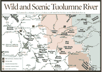 Wild
and Scenic Tuolumne River
Wild
and Scenic Tuolumne River [Fig. 24(1)] One of the most challenging whitewater river runs in the Sierra is several miles south of 268,000-acre-foot Cherry Lake, the large body of water on the southwest flank of the Emigrant Wilderness. The Tuolumne River whitewater run covers about 18 miles as it winds, leaps, and rushes toward Don Pedro Reservoir in the foothills to the west.
The river is one of two major streams leaving Yosemite National Park, south of the Emigrant. The river's glacial ancestry is apparent in the granite canyons carved deep into the Sierra batholith over the last 2 million years.
The whitewater run is a virtual slalom course of boulders. It escalates in intensity with staircase rapids, chutes, and pools by the score as it comes down the mountain. Few people would challenge it until the mid-1970s when the U.S. Forest Service counted 1,200 boaters making the trip in 1975. Now, the federal government limits noncommercial rafters to 90 persons per day between May and October. The art of river rafting has progressed and most rafters have far more expertise now than they did 20 years ago. But there are also a lot more rescues because there are also a lot of people who do not understand how wild the river is. This river is considered Class IV to V rapids. A Class I is a fairly flat, placid stream, and a Class VI is steep, treacherous, and not navigable. Most people boat the Tuolumne with a recognized commercial rafting company, and there are eight.
The Tuolumne is a prime water source for the city of San Francisco. The water coming out of Hetch Hetchy Valley in Yosemite on the Tuolumne is so pristine that San Francisco has been one of the largest cities in America that does not treat its river water before sending it to the taps. Visitors might look at the streamside areas where the river's rapids calm down and become gentler. Amphibians can be found there. They include the red-legged frog (Rana aurora) and the California newt (Taricha torosa).
The newt feasts on earthworms, snails, and slugs, which are found in abundance around the Tuolumne River in the loose soils at lower elevations. The newt spends most of its time out of the water. Look for the reddish-brown color on top and a yellow-orange color below on the body of the newt. Reptiles are also all around. Look for the Gilbert's skink (Eumeces gilberti), southern alligator lizard (Gerrhonotus multicarinatus), and striped racer (Masticophus lateralis).
If visitors hear a distinctive "oooah, coo, coo" in the distance, they will know they have happened upon a common bird that is hunted in the woodlands and sometimes around streams such as the Tuolumne. It is the mourning dove (Zenaida macroura), a seed-eating bird often found around the river year-round. The dove's call is the best way to identify it, but if in doubt, watch the bird walk. If the head bobs back and forth in an almost comical gait after the "oooah, coo, coo," the bird probably is a dove.
Read and add comments about this page